


The Calais Waterfront Walkway is a one mile trail following the route of the former Maine Central Line to the heart of downtown Calais, Maine. The rail right of way has been transformed into a spectacular promenade, which follows the St. Croix River from the Library at Pikes Park westerly to Todd Street, and also southerly to South Street. The Walkway is paved with crushed stone and is handicap accessible. There are several benches and picnic tables along the trail for the convenience of the public.
This is the original bed of the Calais Railway (Chartered 1832), the first charter issued by the State of Maine. Visitors are impressed by the transition from the bustle of the downtown to the tranquility, found several hundred feet down the trail after passing through the Main Street underpass. The historic river offers many outstanding vistas along the way. Bald Eagles scan the waters for prey from several perches located only feet from the trail. The opposite shore is St. Stephen, New Brunswick, Canada, where a system of parks and trails is also being developed on the waterfront. This is within easy walking distance, as the trail passes with one hundred yards of the international bridge.
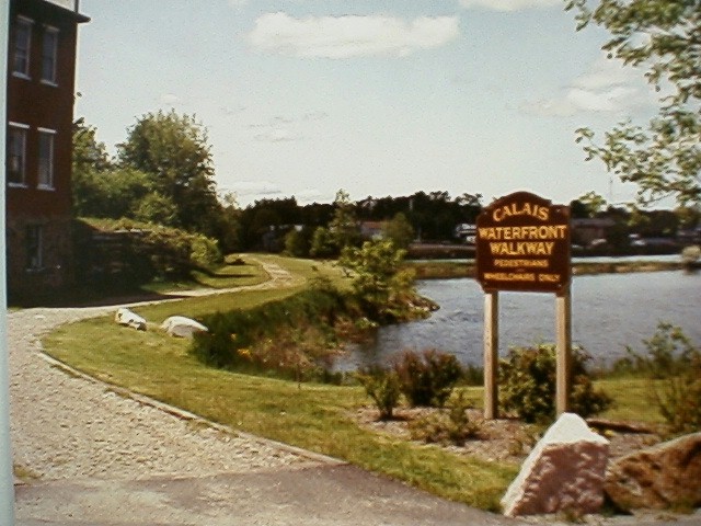
Calais Waterfront Walkway. Picture supplied by the City of Calais

Calais Waterfront Walkway. Picture supplied by ECGA.
Click on the map to browse!
Information about the simultaneous dedication of trailhead markers for the East Coast Greenway in Calais and Key West on National Trails Day, June 2, 2001.
A 1.5 mile section of the Trail within Calais is briefly described in section G of the Official Rails-to-Trails Conservancy New England Guidebook by Cynthia Mascott published in 2000 by Globe Pequot Press.
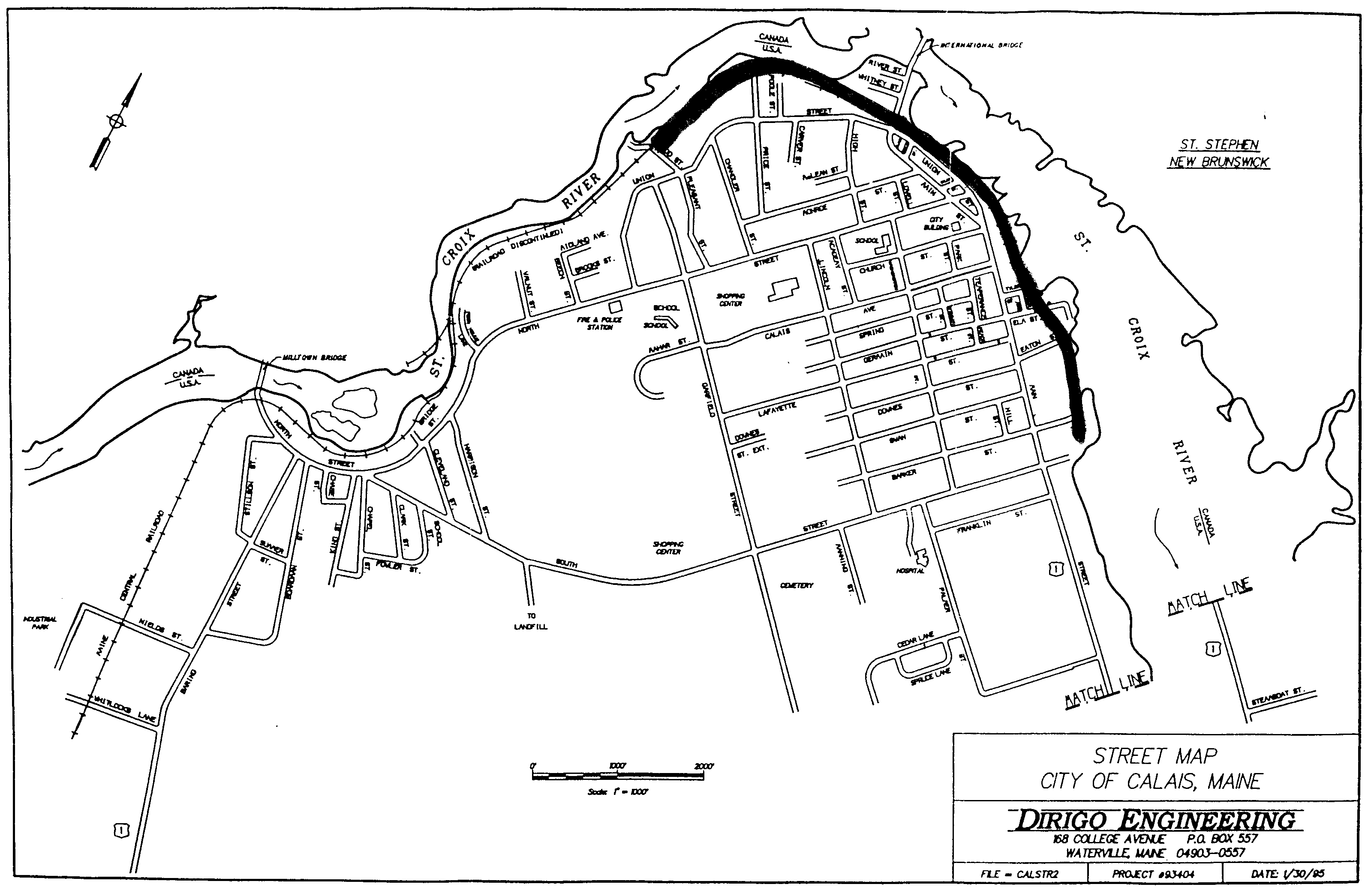
The preceding map is a link to a map on the Mapblast Web Site that in turn contains a link to a Business Directory of the surrounding area.
 West's
Coastal Connection provides daily intercity bus
transportation between Calais and Bangor. This bus connects with Vermont
Transit (Greyhound),
Concord Trailways, and
Cyr Bus Line at Bangor. Bicycles are accommodated inside
this bus!
West's
Coastal Connection provides daily intercity bus
transportation between Calais and Bangor. This bus connects with Vermont
Transit (Greyhound),
Concord Trailways, and
Cyr Bus Line at Bangor. Bicycles are accommodated inside
this bus!
Vermont Transit (Greyhound) and SMT offers intercity bus service at St Stephen (across the International Bridge) on weekends only to Boston and St. John. Note that a condensed version of the SMT schedule is shown in the Vermont Transit timetable for Maine. Vermont Transit accepts bicycles in boxes as part of the passenger baggage allowance (Boston to Bangor). Cyclists are encouraged to ask SMT about their bicycle policy.
 Pleasant
Point Transportation operates a public bus service between the
Pleasant Point Indian Reservation and downtown Calais on Wednesday &
Friday only. Cyclists are encouraged to inquire about the bicycle policy
of this bus. Indian Township Transportation presumably provides a
corresponding bus service between the Indian Township Reservation and downtown Calais.
Pleasant
Point Transportation operates a public bus service between the
Pleasant Point Indian Reservation and downtown Calais on Wednesday &
Friday only. Cyclists are encouraged to inquire about the bicycle policy
of this bus. Indian Township Transportation presumably provides a
corresponding bus service between the Indian Township Reservation and downtown Calais.
| Item | From | To | Year | RR | Miles |
|---|---|---|---|---|---|
| 359 | at Calais | 1984 | MC | 0.8 |
MC - Maine Central Railroad
Sign images are from the Manual of Traffic Signs by Richard C. Moeur.
Updated on August 06, 2001 by Kenyon F.
Karl <[email protected]>.
Unintentional errors are likely!

Add Language Translation to your browser from the Babel Fish Tool page from AltaVista: