


|
|
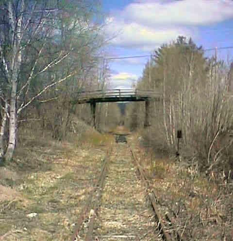
East from Halcyon. Digital photograph by Kenyon F. Karl on March 4, 1998.
 Rails and ties are still in place for a 6 mile stretch from Webster Lake Station
though
Halcyon Station to Ice House Road as of September 16,2000. All ties have been removed
west of Ice House Road (a mile or so west of
Halcyon Station) but a thick layer of crushed stone ballast
remains in place on the railroad bed.
Rails and ties are still in place for a 6 mile stretch from Webster Lake Station
though
Halcyon Station to Ice House Road as of September 16,2000. All ties have been removed
west of Ice House Road (a mile or so west of
Halcyon Station) but a thick layer of crushed stone ballast
remains in place on the railroad bed.
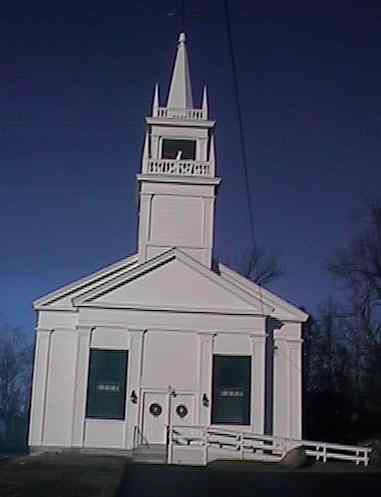
Andover Congregational Church visible from Halcyon Station. Digital photograph by Kenyon F. Karl on December 18, 1999.
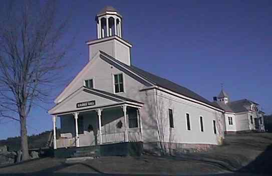
Highland Lake Grange and an old school building visible from Halcyon Station. Digital photograph by Kenyon F. Karl on December 18, 1999.
Due to highway reconstruction, Route 11 now crosses the trail at grade near Plains Rd about 1.7 miles southwest of Halcyon Station. This new trail crossing replaces a railroad overpass of Plains Road and the old wooden Route 11 highway overpass with severe weight limits at a different location.
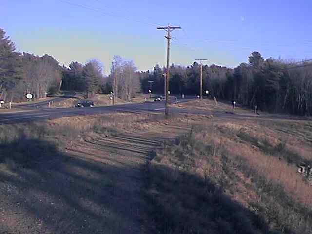
The new grade crossing at Route 11 and Plains Road. Digital photograph by Kenyon F. Karl on December 18, 1999.
Simple trail access is available from nearby roads at the following points:
Dyers Crossing Road about 1.9 miles north and east of Halcyon Station.
A sidewalk to Route 11 at Halcyon Station (across the highway from the General Store).
West 1st St Crossing, a short distance south of Halcyon Station.
A camp road crossing about 0.7 miles south of Halcyon Station.
The new trail crossing of Route 11 at Plains Rd about 1.7 miles southwest of Halcyon Station.


 A general store is located across the highway from Halcyon Station that offers
limited groceries, beverages and refreshments. The store also offers a small
dining area where a limited menu of hot lunches are served on a daily basis.
Toilets and water are available upon request. The store is open 6 am to 8 pm on
a 7 day per week basis. A public phone is located outside where it is available
at all times.
A general store is located across the highway from Halcyon Station that offers
limited groceries, beverages and refreshments. The store also offers a small
dining area where a limited menu of hot lunches are served on a daily basis.
Toilets and water are available upon request. The store is open 6 am to 8 pm on
a 7 day per week basis. A public phone is located outside where it is available
at all times.
 The East
Andover Post Office is located just west of the general store.
The East
Andover Post Office is located just west of the general store.
 Signs at the
intersection of Maple Street (the wooden road overpass just east of Halcyon
Station) suggest that two
Bed & Breakfasts are located near by.
Signs at the
intersection of Maple Street (the wooden road overpass just east of Halcyon
Station) suggest that two
Bed & Breakfasts are located near by.
The trail map at the Andover
Snowmobile Club Web Site shows several side trails that leave the railroad
bed west of Halcyon Station to:
Any Mapblast Map on this Web Site is a link to the Mapblast Web Site which in turn leads to a Business Directory of the surrounding area.
