


|
|
The station location was confirmed by the visible remains of the passenger platform.

Former Canaan Depot. Digital picture by Kenyon F. Karl on March 4, 1998.
The station building has been recently remodeled to house a Laundromat and an upstairs apartment. The trail runs on the right side (south) of this building. Note that a fence was built in 1999 to enclose the station platform area, presumably to preserve the privacy of the upstairs tenants of the building.
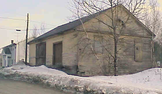
Former Canaan Freight House. Digital picture by Kenyon F. Karl on March 4, 1998.
The freight house across Depot Street from the former station building looks like it was abandoned many years ago. The trail runs across the rear (south) of this building.
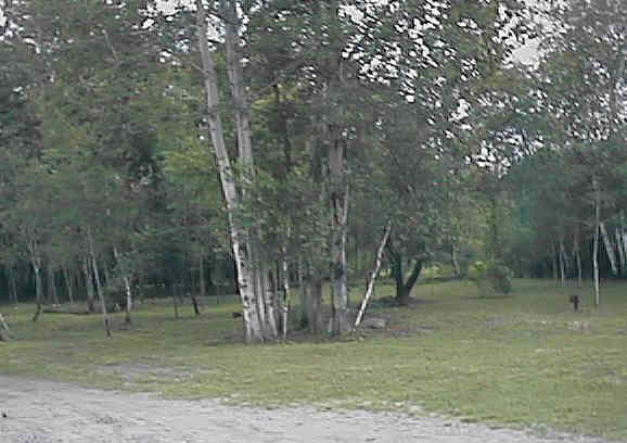
Old Depot Park across from the former Depot. Digital picture by Kenyon F. Karl on March 4, 1998.
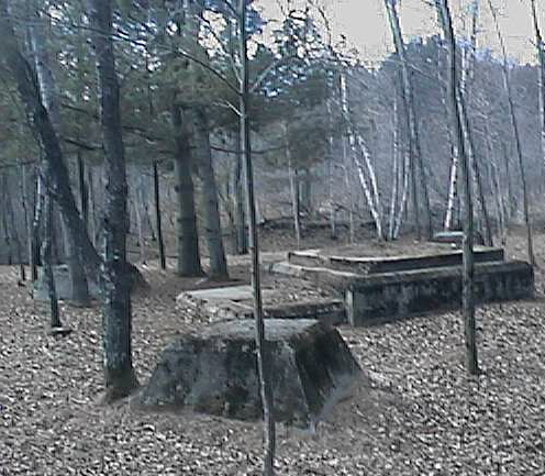
Remains of a large water tower that once provided water for steam locomotives. Digital picture by Kenyon F. Karl on April 12, 1999.
The Friends of Canaan Main Street has cleared the state-owned wooded area across the trail from the Depot of weeds and brush in the late spring of 1998. Later in the year, they furnished the grove with two picnic tables for trail users and townspeople. A Bicycle Rack was also noted next to the Fibre Optics Equipment shack across from the end of Depot St.
A large water tower across from the Canaan Depot replenished the enormous quantity of water used by the steam engines as they climbed the grade from Westboro to the summit of the railroad east of Canaan. Accordingly, all steam-powered trains probably stopped at Canaan to take water. Explorers of the wooded picnic grove ought to be able to discern the roadbed of the 'Y' shaped track on the grounds that was used to turn the helper locomotives returning to the Westboro Roundhouse in West Lebanon.
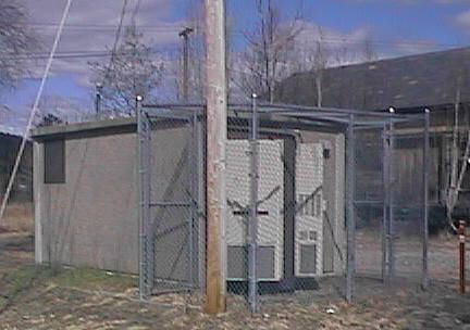
An equipment shack at Canaan Station for the AT&T Fibre Optics Cable that runs at one side of the Rail-trail. Digital picture by Kenyon F. Karl on April 12, 1999.
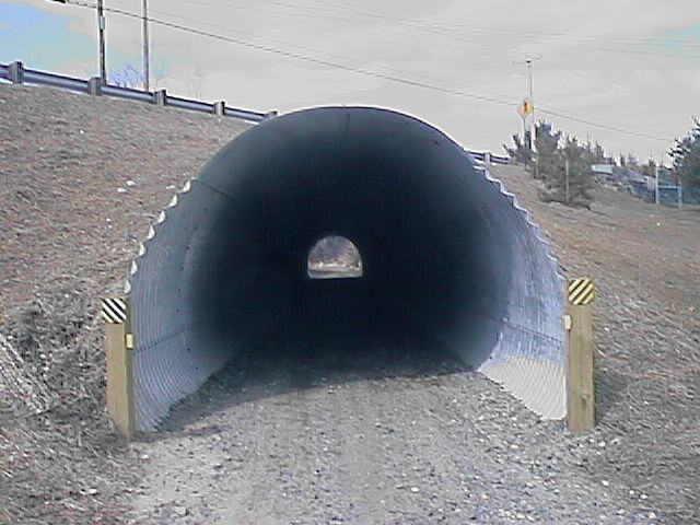
Trail culvert under Route 4 just west of Canaan Station. Digital picture by Kenyon F. Karl on April 12, 1999.
Early Days. Canaan was formed by charter in 1761, and the early settlers from Connecticut arrived in 1766 and 1767. At first, wagon and foot paths wound their way between homes and settlements. Grain mills were built along the rivers as the community grew and these became centers of activity for business. Eventually, lumber mills provided boards for larger and more substantial houses. Roads were laid out and built beginning with South Road in 1774. Many roads built in the late 1770's and 1780's led directly to the Eames corn mill by the outlet of Harts Pond (now called Canaan Street Lake). By 1793 the record of taxpayers listed 124 names.
New construction clustered along well traveled roads and near established businesses. Canaan Center was called Factory Village then for the broom handle factory and many mills. Inns, liveries, grocery stores, and fine homes were built along Broad Street (Canaan Street) by the late 1800's. That carefully planned street, part of the Turnpike, gained early prominence by the location of the Town Meeting House completed in 1796. West Canaan experienced growth with the arrival of the railroad in 1847 and the location of its busy station stop.
Expansion in East Canaan (now known as Canaan Village) was at first stimulated by the nearby Fourth New Hampshire Turnpike. The downtown area grew rapidly after the railroad company built its depot on land offered by Richard Hutchinson, a local farmer. Depot Street was laid out in 1848 to connect with the Turnpike and in a short while East Canaan became the town's major trade center. By 1884, more than 33 small businesses were flourishing downtown.
On June 2, 1923 a great fire completely destroyed the heart of Canaan Village and more than fifty businesses and residences were burned to the ground. Work to rebuild the village started immediately. The Canaan Rehabilitation Corporation was formed and laid out new lots, widened streets, and planned the Green and Williams Field. The Canaan Improvement Society supervised the design and planting of trees and shrubs. A Board of Trade formed and published an attractive brochure about the beauty of Canaan in order to attract developers. The sturdy buildings of that time - the Block, Municipal Building, and Market on the corner of Main and Depot streets, Post Office, Reporter Building, hardware store and railroad building on Depot Street tell us that there was a great investment in the future of the business district. Elm trees were planted along the curbstone sidewalks. A new road, Route 4, cut through the village providing motorists with a major link to the cities of Concord and Lebanon.
By the 1930's much of downtown Canaan had been rebuilt. Canaan continued to be a destination for vacationers who arrived by train in all seasons. Up through the 1950's the downtown area was busy as residents came into town to do their weekly shopping, attend a movie, have lunch or dinner at the Canaan Inn, or Diner or a drink at one of the cafes. The new Boston & Maine Railroad Station was a hub of activity for loggers, farmers, and manufacturers who shipped their products by rail. Residents received their grain, machinery, and supplies by train. Passenger trains stopped at the Village depot day and night.
Today. While a large number of our residents commute to work in Lebanon, Hanover and White River Junction, a look through this directory reveals that a great variety of small and home-based businesses continue to thrive in our rural community. These range from seasonal snowplowers to artisans, financial consultants to manufacturing companies. West Canaan and Canaan Center have maintained their identities and locally owned stores offer a convenience for the families there.
Canaan Village retains grocery and hardware stores, post office, restaurants, barbershop, and medical facilities. Our popular library and town offices bring residents to town for pleasure and business. The village contains the meeting halls of social groups and three churches serve area residents. Canaan Village continues to be the hub of Town activity. It also contains a significant concentration of historic, culturally significant structures which provide character and interest for residents and visitors.
To learn more about the history of Canaan, visit the Historic Museum on Canaan Street during its open hours in the summer and talk with Donna Dunkerton, town historian. Our town library has Wallace's history of Canaan as well as other publications for study. The Historical Society is another good resource and welcomes new members.
A Directory of Services has been published by The Friends of Canaan Main Street, Inc. Our mission statement is "To foster the sense of community (neighbor helping neighor) by creating opportunities for residents to develop a growing and diverse base of community centered work, educational and recreational resources; to restore a town-wide positive linage of the village center. " Meetings take place at 7:00 pm on the first Monday of each month at the Senior Center. All are welcome to attend. Residents who enjoy "digging in" and getting specific projects complete may want to take part in the 8-10 activities from 8:00 to 10:00 am on Saturday mornings. For more information write to:
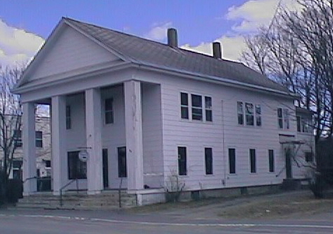
A classic building on Depot Street now used as a real estate office. Digital picture by Kenyon F. Karl on April 12, 1999.
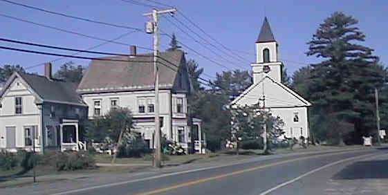
United Methodist Church and neighboring house in Canaan. Digital picture by Kenyon F. Karl on July 25, 1998.
|
|

Mirror pond. Digital photograph by Kenyon F. Karl on December 19, 1999.
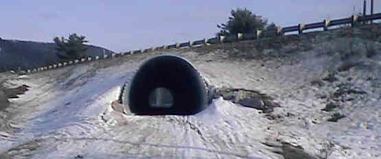
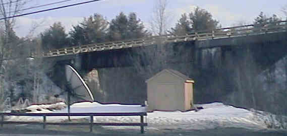
Highway Overpass in Orange. Digital picture by Kenyon F. Karl on March 4, 1998.
The trail culvert about 1.6 miles east of Canaan Station may be too small for equestrian users!
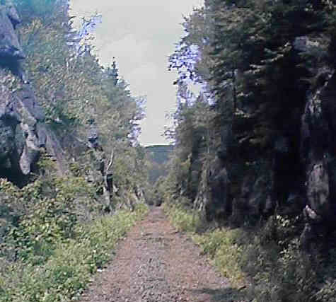
Deep rock cut in Orange at the highest point of the rail-trail. Digital picture by Kenyon F. Karl on July 4, 1998.
A deep rock cut is located about a mile east of the overpass in Orange. This point is reportedly the actual summit of the line between Concord and White River Jct. Summit Siding must have been on the curve a short distance west of this point.
During the steam engine era, an extra locomotive would be attached to the rear end of the train at Westboro Station to push the train to summit siding. The locomotive would then be uncoupled at that point, run backwards to Canaan, then turned on the 'Y' shaped track behind the Canaan water tower so that it could be run forward back to the Westboro roundhouse in West Lebanon.
Trail access points:
High Bridge over Indian River. Digital picture by Kenyon F. Karl on March 4, 1998.
The trail crosses runs the Indian River on a high railroad bridge about 0.9 mile west of the former Canaan Station, then runs right alongside the busy and narrow Route 4.
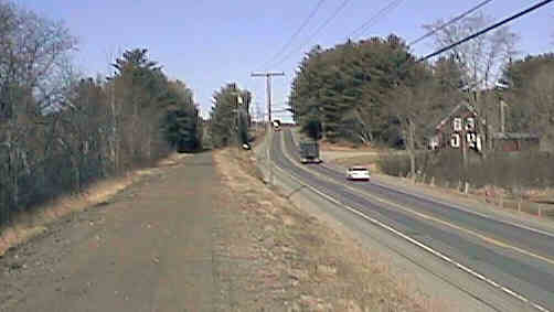
The Rail-trail runs along Route 4 a short distance west of the Indian River Bridge. Digital picture by Kenyon F. Karl on April 30, 1999.
Public access points to the Rail-trail (Bus stops on nearby Route 4 indicated by asterisk):
Simple trail access is available at the following road crossings:
US Route 4 is directly accessible from US 4, about 2.1 miles east of Canaan Station.
Directly to US 4 about 1.0 miles west of Canaan Station.
Directly to US 4 about 1.5 miles west of Canaan Station.
Potato Road (north a short distance to US 4), about 1.9 miles west of Canaan Station.
 The Advance
Transit Blue Route terminates in parking lot of the
United Methodist Church, a short distance north and west of the
former depot. West of that point, the bus stops on signal
anywhere along Route 4, so
that the bus is easily accessible from the following public access points. Note that all Advance Transit busses
now have bike racks!
The Advance
Transit Blue Route terminates in parking lot of the
United Methodist Church, a short distance north and west of the
former depot. West of that point, the bus stops on signal
anywhere along Route 4, so
that the bus is easily accessible from the following public access points. Note that all Advance Transit busses
now have bike racks!
Directly to US 4 about 1.0 miles west of Canaan Station.
Directly to US 4 about 1.5 miles west of Canaan Station.
Potato Road (north a short distance to US 4), about 1.9 miles west of Canaan Station.
 US Route 4 is a Statewide
Bicycle Route that roughly parallels the Rail-trail between Danbury and Lebanon.
Each of the following trail access points thus forms a short connecting link to
the Bike Route.
US Route 4 is a Statewide
Bicycle Route that roughly parallels the Rail-trail between Danbury and Lebanon.
Each of the following trail access points thus forms a short connecting link to
the Bike Route.
US Route 4 is directly accessible at Summit Siding, about 2.1 miles east of Canaan Station.
Directly to US 4 about 1.0 miles west of Canaan Station.
Directly to US 4 about 1.5 miles west of Canaan Station.
Potato Road (north a short distance to US 4), about 1.9 miles west of Canaan Station.
An undesignated
bike route to the Grafton
Pond Reservation runs about 5 miles along Potato Road.
 Picnic tables are located in the
grove across from the former Canaan Depot.
Picnic tables are located in the
grove across from the former Canaan Depot.
 Limited groceries and refreshments are available at a convenience store on
Depot Street near the abandoned Freight House.
Limited groceries and refreshments are available at a convenience store on
Depot Street near the abandoned Freight House.


 The gasoline
station and convenience store on Route 4 just west of Depot Street has limited
groceries, refreshments and drinking water. A toilet is available
upon request. The police station is
at the west end of the white town hall building, with an entranceway that is almost obscured by the adjacent gasoline
station. Public phones are available across the street from the gasoline
station. Note the pedestrian passageway directly to the Rail-trail.
The gasoline
station and convenience store on Route 4 just west of Depot Street has limited
groceries, refreshments and drinking water. A toilet is available
upon request. The police station is
at the west end of the white town hall building, with an entranceway that is almost obscured by the adjacent gasoline
station. Public phones are available across the street from the gasoline
station. Note the pedestrian passageway directly to the Rail-trail.
 The Library is on the
first floor of the white town hall at the intersection of Depot St.
and Route 4.
The Library is on the
first floor of the white town hall at the intersection of Depot St.
and Route 4.
 Sheltered picnic tables, drinking water,
and toilets are available at Williams Field. Note that this field can be reached
from the west end of the river bridge (just West of Canaan Station) and passing
across the grass along the fence at the side of the baseball field. Note that
these facilities might be available only during the warm weather months.
Sheltered picnic tables, drinking water,
and toilets are available at Williams Field. Note that this field can be reached
from the west end of the river bridge (just West of Canaan Station) and passing
across the grass along the fence at the side of the baseball field. Note that
these facilities might be available only during the warm weather months.
 A pizza
shop across Route 4 from Williams Field is open until 9 pm on a daily
basis. Toilets and water are available in the restaurant upon
request. A picnic table is located on the front lawn of the restaurant. Note also that a seasonal ice
cream stand is located next to the Route 4 entrance to Williams Field.
A pizza
shop across Route 4 from Williams Field is open until 9 pm on a daily
basis. Toilets and water are available in the restaurant upon
request. A picnic table is located on the front lawn of the restaurant. Note also that a seasonal ice
cream stand is located next to the Route 4 entrance to Williams Field.
 The post office is across Route 4
from Williams Field adjacent to the Pizza Shop.
The post office is across Route 4
from Williams Field adjacent to the Pizza Shop.
Sign images are from the Manual of Traffic Signs by Richard C. Moeur.
Updated on February 14, 2001 by Kenyon F.
Karl <[email protected]>.
Unintentional errors are likely!
