Click on the map for related maps and a Yellow Pages directory of the area!
The westernmost three miles of railroad track was purchased by the State of New Hampshire from the Boston & Maine Railroad in the fall of 1999 with the intent of finding an operator to provide rail freight service to the gravel pit and nearby industrial sites. When it is determined how much of this railroad line will actually be used, the state is expected to transfer administration of the remainder to the NH Bureau of Trails for recreational uses. The Friends of the Northern Rail-Trail in Grafton County is the logical applicant for local coordination of this trail extension.
The potential trail extension would begin at the Spencer Street Crossing behind a small white building on the remains of the former passenger station platform, then run along a retaining wall that separates the upper and lower parking lot for the downtown Mall. It would then use the railroad tunnel to pass under the Mall and Route 4, emerging to cross the river parallel to Mechanic Street near High Street.
The trail would continue from the High Street Grade crossing on an elevated railroad grade adjacent to Mechanic Street, then cross Slayton Hill Road on the old railroad overpass. An ADA-compliant trailhead as close as is practical to the entrance to Alice Peck Day Hospital complex would be an important feature of this trail extension.
The trail would continue on the railroad bed, crossing behind Longacres Garden Supplies on a high embankment, then over I-89 on the railroad overpass. It would then run behind and many feet below the Split Ball Bearing factory and the adjacent Miracle Mile Shopping Center.
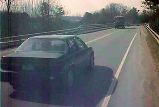
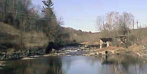
West across Route 4 overpass near Miracle Mile. Digital picture by Kenyon F. Karl on March 10, 1998.
North across abandoned road adjacent to the Route 4 overpass. Digital picture by Kenyon F. Karl on March 10, 1998.
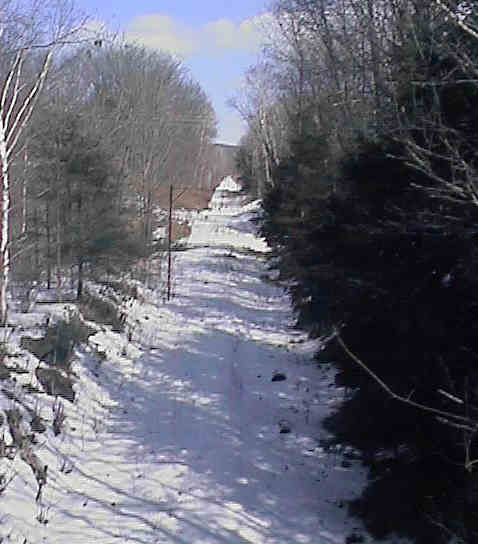
West from abandoned road overpass. Digital picture by Kenyon F. Karl on March 10, 1998.
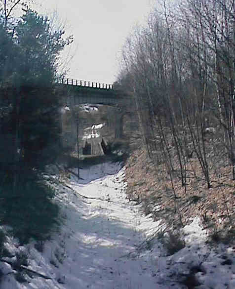
East from abandoned road overpass. Digital picture by Kenyon F. Karl on March 10, 1998.
Remains of the old mill and its associated dam behind the Miracle Mile Shopping Center. Digital picture by Kenyon F. Karl on May 30, 1999.
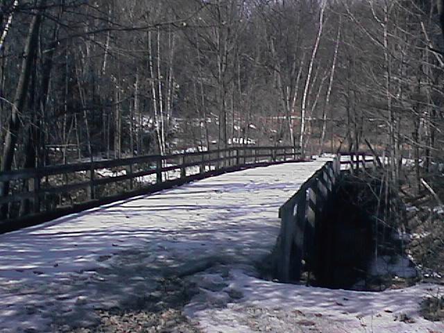
A long forgotten wooden overpass begins adjacent to the northeast end of the current Route 4 river bridge and turns to easward to ramp down to ground level eastward to ground level to provide road access to an abandoned mill site and dam on the river. This bridge and ramp can probably be rehabilitated and connected to the rail-trail at minimal cost to serve as an exit for trail users that wish to use the Seminary Hill route to West Lebanon. Note however that the grade on the ramp may exceed ADA standards.
The Miracle Mile Shopping Center is about an eighth of a mile from this proposed trailhead, via the front parking lots of the intermediate business firms. The Center contains a major grocery store (open 24 hours/day), a theater complex, several smaller stores, and an Advance Transit Bus stop. Ample parking space is probably available for trail users without interfering with mall customers except during the Christmas Shopping Season. Note that an access road constructed for sewer maintenance purposes connects the rear of this parking lot to the rail-trail.
Hikers and bikers headed for the potential Westboro - White River Junction Rail-with-Trail should have the opportunity to leave the trail at the Miracle Mall Trailhead to use Route 4 over Seminary Hill as a short bypass for the probable long-term gap in the trail between the Stone Arch Underpass on Glenn Road and the Westboro Trailhead. Note that this route would be particularly attractive for bike commuters. Unfortunately, the Route 4 river bridge to the east end of Seminary Hill, was never designed for pedestrian and bike usage. However, it is planned to add a bikeway/sidewalk to the bridge during a future bridge rehabiliation project.
There is likewise no sidewalk for the quarter-mile of highway just west of the bridge, although there appears to be sufficient room for a multi-purpose trail on the adjacent former roadbed. The sidewalk over the rest of Seminary Hill to the Junction of Route 12A was obviously designed for pedestrian usage only, although there appears to be sufficient room to widen it for bike usage. This bypass route would then turn south onto the narrow sidewalk of Route 12A to overpass the active railroad track then make a sharp U-turn at southwest corner into the probable trailhead for the potential Westboro - White River Junction Rail-with-Trail.
Click on the map to browse!
Glen Road and the railroad are at the same level and adjacent to each other at about halfway between Route 4 and the Stone Arch Underpass. Because of the probable cost of building ADA compliant trailheads at Miracle Mile and Stone Arch Underpass, a very small but economical trailhead is strongly suggested at this location for disabled trail users. Because of its location and the great hazards of walking or biking along this narrow and winding section of Glen Road, other trail users are unlikely to use this trailhead. Note however that fishermen might use this trailhead for access to the adjacent river. In any event, this trailhead would certainly be used for maintenance and emergency vehicle access to the trailbed.
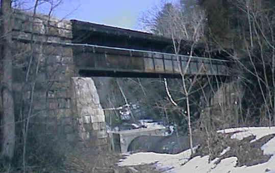
Side view of easternmost river bridge. Digital picture by Kenyon F. Karl on March 10, 1998. This picture can be sent to any Netizen as a Free Virtual Postcard.
The trail would then continue down the railroad bed to the easternmost crossing of the Mascoma River near Glen Road. Because of the active railroad track will probably occupy the track bed from this point on, a suitable ramp to ground level must be built between that bridge and the Stone Arch Underpass into the largely unused east end of the adjacent Bascetta Park. For cost reasons, the ramp will probably be too steep for ADA compliance - although its design should make provision for a future upgrade for that purpose.
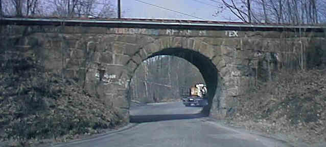
Side view of Stone Arch Underpass. Digital picture by Kenyon F. Karl on March 10, 1998.
East across earth mound at Bascetta Park. Digital picture by Kenyon F. Karl on March 10, 1998.
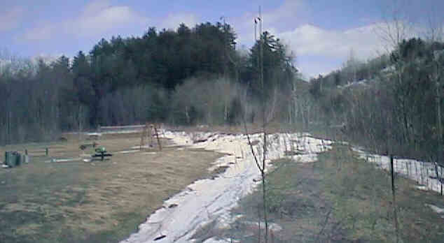
The central portion of the park currently offers limited vehicle parking, a few picnic tables and a playground to trail users. The trail would probably pass along the back edge of the park along the top of the low mound that runs along the river bank. Note however that this mound would require rehabilitation for trail usage
Click on the map to browse!
At the west end of the low mound along the river, the trail would continue along unused land between Glen Road and the river for another quarter mile to a final trailhead at the far end of the easternmost parking lot of the Powerhouse Mall. Ample parking for trail users is probably available within that parking lot without inconveniencing shoppers, except during the Christmas Shopping Season. The Eastern Mountain Sports store at that end of the mall ought to be willing to provide a staffed information center for trail users within their store. All of the other important trailhead facilities can probably be found elsewhere within the Mall during normal mall shopping hours.
The Advance Transit Bus Stop is located at the main entrance to the mall, served by the Red Route (Lebanon-West Lebanon - Malls).
The Powerhouse Mall is at the north end of a major commercial strip containing a wide variety of fast food outlets and other stores of all kinds. A few restaurants and fast food outlets, a major grocery store, a pharmacy, and a few other stores are easily and safely reachable within the north east corner of this commercial strip. However, the rest of this very busy highway-oriented shopping area is decidedly hazardous for bikers and pedestrians, and thus trail users destined to other places in the complex should be advised to ride the Advance Transit Bus to their final destination!
 Listed on the
National Register
of Historic Places:
Listed on the
National Register
of Historic Places:Stone Arch Underpass Glen Rd. Lebanon
Sign images are from the Manual of Traffic Signs by Richard C. Moeur.
Updated on February 14, 2001 by Kenyon F.
Karl <[email protected]>.
Unintentional errors are likely!
