


Local coordination is provided by:
Friends of Pisgah
|
|
![]() USGS
Topographic map of Asheulot
USGS
Topographic map of Asheulot
Official brown trail signs as well as a spot-check conducted on July 7, 1998 at all public road crossings indicate that the trail is usable in both directions from the Asheulot Depot.
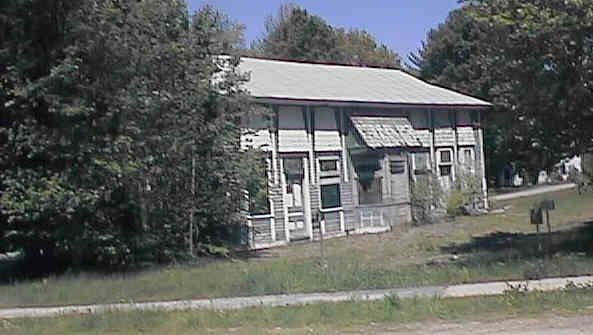
Asheulot Depot in Winchester. Digital photograph by Kenyon F. Karl on May 19, 1998.
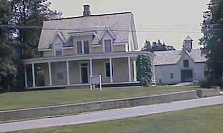
Sheridan House. Digital photograph by Kenyon F. Karl on July 7, 1998.
 The Ashuelot Bridge (Covered Bridge #1) is near the Asheulot
Depot.
The Ashuelot Bridge (Covered Bridge #1) is near the Asheulot
Depot.
The Sheridan House is adjacent to the Asheulot Depot. The sign in
front of this historic building notes that it has been restored
by the Winchester Historical Society.
 The Asheulot Post Office is located across the covered bridge and
a short distance west on Route 119.
The Asheulot Post Office is located across the covered bridge and
a short distance west on Route 119.
Note that the trail is located at the south (back edge) of the old mill buildings that are visible from Route 119 at Recycle Way Bridge. The trail runs alongside a series of overgrown green boxcars that line an isolated railroad track along the back side of the mill. Railfans will note that the boxcars are painted for the Green Mountain Railroad and are numbered as GMRC 399, 382, 379, 378, 360, 398, 350, 383, & 391.
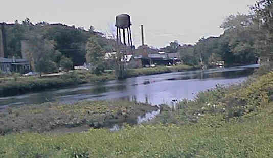
Old Mill Buildings visible from Recyle Way Bridge. Digital photograph by Kenyon F. Karl on July 6, 1998.

Trail alongside old boxcars at Mill. Digital photograph by Kenyon F. Karl on July 6, 1998.

 The Old
Reservoir Road entrance to Pisgah
State Park is just across Route 119 from the Recycle
Way Bridge. Additional information about the State Park is available at the
following Web References:
The Old
Reservoir Road entrance to Pisgah
State Park is just across Route 119 from the Recycle
Way Bridge. Additional information about the State Park is available at the
following Web References:
Pedaling New England - Pisgah State Park - Another copy of what appears to be the same information
Pictures and descriptive text of Pisgah State Park from a personal Web Page.
Mountain Biking at Pisgah State Park from the Adventure Files Web Site
 Ample trail parking is available on an informal
basis on the south side of the Recycle Way bridge. More parking should be
available in the Pisgah State Park Lot just across Route 119 from the Recycle
Way Bridge.
Ample trail parking is available on an informal
basis on the south side of the Recycle Way bridge. More parking should be
available in the Pisgah State Park Lot just across Route 119 from the Recycle
Way Bridge.
 Community
Information for Winchester from the Keene
Sentinel
Community
Information for Winchester from the Keene
Sentinel
Any Mapblast Map on this Web Site is a link to the Mapblast Web Site which in turn leads to a Business Directory of the surrounding area.
Sign images are from the Manual of Traffic Signs by Richard C. Moeur.
Updated on February 24, 2001 by Kenyon F.
Karl <[email protected]>.
Unintentional errors are likely!
