


![]() USGS
Topographic map of Rochester
USGS
Topographic map of Rochester
The 1984 edition of the Delorme New Hampshire Atlas and Gazetteer suggests that the Rochester Depot was located alongside Columbus Avenue between Summer and Hanson Street on a stretch of railroad track that is still active.
The rail-trail begins on an informal basis alongside Columbus Avenue, just north of Summer Street. The trail continues north past the Bennett Footwear Group factory to Wakefield Street (Route 125).
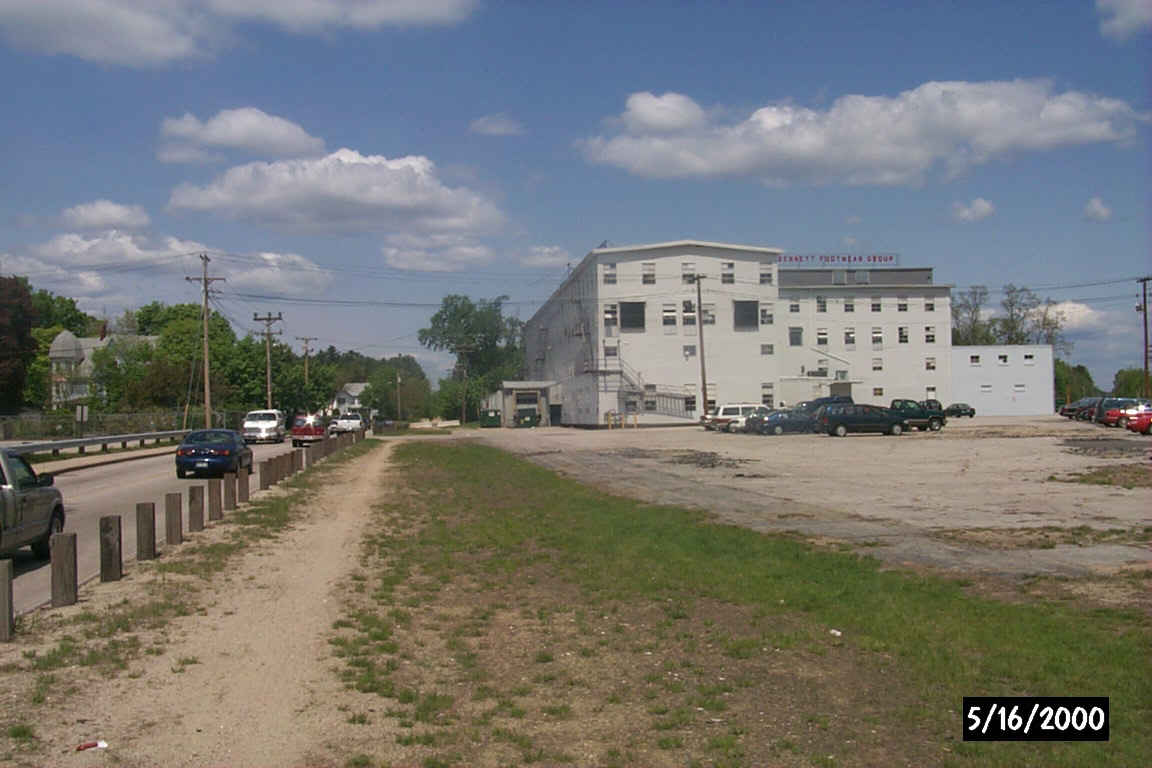
The informal beginning of the rail-trail along Columbus Avenue in Rochester. Digital photograph by Kenyon F. Karl on May 16, 2000.
The formal beginning of the rail-trail is at Wakefield Street (Route 125) across from the end of Columbus Avenue. After running north behind some houses, it passes between the Spaulding High School and the Hanson Pines City Park, and continues alongside the high school building complex and then alongside Chestnut Hill Road until it passes under the Spaulding Turnpike (Route 16).
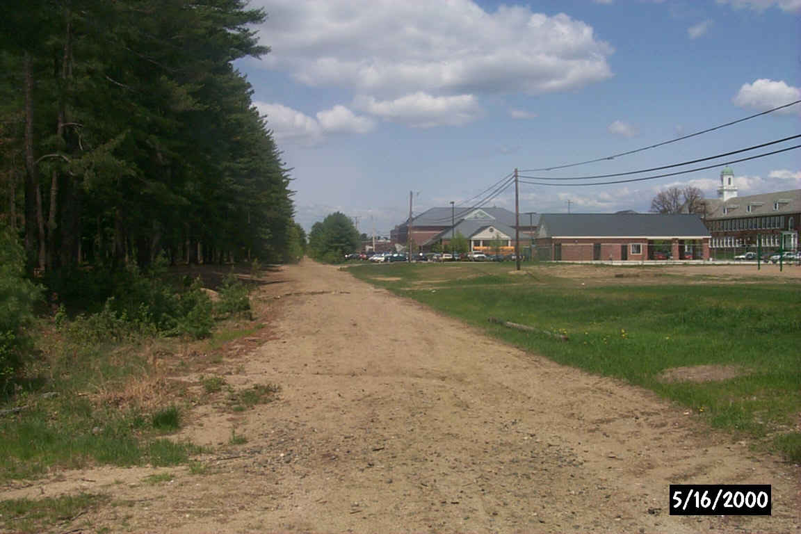
The rail-trail continues between a city park and the High School. Digital photograph by Kenyon F. Karl on May 16, 2000.
The trail then crosses the Cocheco River to cross Little Falls Bridge Road near Route 11. The trail then continues northwest alongside Route 11 towards Farmington.
 Municipal parking is available behind City Hall and Opera House with an entrance
from Columbus Avenue just south of the informal beginning of the rail-trail.
Municipal parking is available behind City Hall and Opera House with an entrance
from Columbus Avenue just south of the informal beginning of the rail-trail.


 A restaurant at the corner of Columbus & Portland Streets presumably offers
toilets and drinking water upon request. The restaurant is open 6am to 7pm Mon
through Sat, and 7am to 2pm Sundays. The telephone is outside the restaurant and
is thus available at all times.
A restaurant at the corner of Columbus & Portland Streets presumably offers
toilets and drinking water upon request. The restaurant is open 6am to 7pm Mon
through Sat, and 7am to 2pm Sundays. The telephone is outside the restaurant and
is thus available at all times.


 The city park adjacent to the Spaulding High School offers an outdoor swimming
pool (open on a seasonal basis), a playground, and a few picnic tables. Note
that the parking lot is usually full whenever the high school is in session.
The city park adjacent to the Spaulding High School offers an outdoor swimming
pool (open on a seasonal basis), a playground, and a few picnic tables. Note
that the parking lot is usually full whenever the high school is in session.
 COAST
busses stop at Spaulding High School. Note that the current fleet of busses will
not accommodate bicycles or skis, but bike racks will be installed
on the new busses when they finally arrive.
COAST
busses stop at Spaulding High School. Note that the current fleet of busses will
not accommodate bicycles or skis, but bike racks will be installed
on the new busses when they finally arrive.
Route 2 - Rochester - Somersworth - Dover - Portsmouth (Weekdays & Saturdays)
Route 6 - Farmington - Rochester (Weekdays only)
The Route 6 bus also stops along the highway that parallels the rail-trail northwest of Little Falls Bridge Road.

 A gasoline & convenience store on Route 11 adjacent to the Little Falls
Bridge Road Crossing offers a donut stand, sandwiches, snacks, and limited groceries,
as well as toilets and water. The public telephone is inside, and picnic tables
are available just outside the northwest entrance to the building.
A gasoline & convenience store on Route 11 adjacent to the Little Falls
Bridge Road Crossing offers a donut stand, sandwiches, snacks, and limited groceries,
as well as toilets and water. The public telephone is inside, and picnic tables
are available just outside the northwest entrance to the building.

 A commercial campground for tents and trailers is located adjacent to the trail
about a half-mile northwest of the Little Falls
Bridge Road Crossing.
A commercial campground for tents and trailers is located adjacent to the trail
about a half-mile northwest of the Little Falls
Bridge Road Crossing.
Sign images are from the Manual of Traffic Signs by Richard C. Moeur.
Updated on March 02, 2001 by Kenyon F.
Karl <[email protected]>.
Unintentional errors are likely!
