


Click on the map to browse!
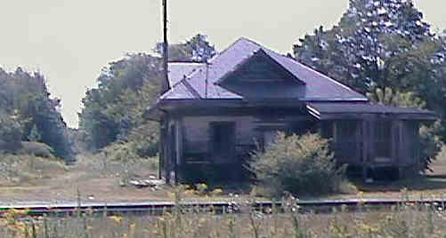
Portsmouth Branch Trail running west from Rockingham Depot. Digital picture by Kenyon F. Karl on August 5, 1998.
The trail turns sharply north at the southwest corner of the unused Rockingham Depot and passes along the west side of the building and ends at the small unsigned parking area on the north side of the Depot.
![]() The railroad track that
passes the east side of the Rockingham Depot is the Guilford
(B&M) main line between the Boston area and Portland, ME. The
track currently carries heavy freight trains running at moderate
speeds, but the entire line has been upgraded for 60 mph or
80 mph speeds for the new Amtrak passenger service between Boston
and Portland. Trail users must note that crossing this main line
track to reach the town road running south from the Depot or the
end of River Road running east and north is a dangerous act of trespass!
Trail users must also
note that the track running east from the highway underpasses is
the still active Guilford (B&M) branch to Portsmouth, Kittery
Naval Shipyard and Hampton. Crossing this track (except at public
road crossings) or any other usage of this railroad property is likewise an
act of trespass.
The railroad track that
passes the east side of the Rockingham Depot is the Guilford
(B&M) main line between the Boston area and Portland, ME. The
track currently carries heavy freight trains running at moderate
speeds, but the entire line has been upgraded for 60 mph or
80 mph speeds for the new Amtrak passenger service between Boston
and Portland. Trail users must note that crossing this main line
track to reach the town road running south from the Depot or the
end of River Road running east and north is a dangerous act of trespass!
Trail users must also
note that the track running east from the highway underpasses is
the still active Guilford (B&M) branch to Portsmouth, Kittery
Naval Shipyard and Hampton. Crossing this track (except at public
road crossings) or any other usage of this railroad property is likewise an
act of trespass.
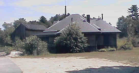
Parking area at Rockingham Depot. Digital picture by Kenyon F. Karl on August 5, 1998.
 The Seacoast
Region map of the Regional
Bicycle Route System shows that a Statewide Bike
Route turns the sharp corner just north of the Rockingham Depot.
Note however that the only safe and legal means of reaching the Regional
Bike Route on River Street east of the trailhead, or traveling south
on the Statewide Bike Route, involves usage of the narrow and extremely
busy Route 108 railroad overpass adjacent to the trailhead!
The Seacoast
Region map of the Regional
Bicycle Route System shows that a Statewide Bike
Route turns the sharp corner just north of the Rockingham Depot.
Note however that the only safe and legal means of reaching the Regional
Bike Route on River Street east of the trailhead, or traveling south
on the Statewide Bike Route, involves usage of the narrow and extremely
busy Route 108 railroad overpass adjacent to the trailhead!
 Limited parking is available on the north side of the Rockingham
Depot building, with overflow parking on the dead end portion of
the town road. Motorists on Route 108 should turn off next to the
Rockingham Country Club just north of the railroad overpass then
drive downhill to the south a short distance to the Depot.
Limited parking is available on the north side of the Rockingham
Depot building, with overflow parking on the dead end portion of
the town road. Motorists on Route 108 should turn off next to the
Rockingham Country Club just north of the railroad overpass then
drive downhill to the south a short distance to the Depot.

 Toilets and water are presumably available at the nearby Rockingham Country Club during
clubhouse operating
hours.
Toilets and water are presumably available at the nearby Rockingham Country Club during
clubhouse operating
hours.
 COAST (#7)
bus passes near the trailhead on Route 108 between
Newmarket and Newfields one trip per day on weekdays only. Bike racks will be installed
on the new busses when they are received - in the meantime this
bus does not accommodate bikes or skis. Since the stop is
not shown on the current bus timetable, potential bus passengers are encouraged
to inquire in advance if the bus will stop at the Rockingham Country Club.
COAST (#7)
bus passes near the trailhead on Route 108 between
Newmarket and Newfields one trip per day on weekdays only. Bike racks will be installed
on the new busses when they are received - in the meantime this
bus does not accommodate bikes or skis. Since the stop is
not shown on the current bus timetable, potential bus passengers are encouraged
to inquire in advance if the bus will stop at the Rockingham Country Club.
Wildcat Transit (#5) operates
a city bus service between Durham and downtown Newmarket on a daily
basis when UNH is in session, with limited service on weekdays
only at other times. Other routes operate from Durham to Dover and Durham to
Portsmouth. Wildcat busses now have bike racks, however the bus does not
accommodate skis. Note that the Statewide
Bicycle Route System appears to offer a circuitous route to the
nearest bus stop at Packers Falls Rd @ Rte 152 near downtown Newmarket.
 Amtrak's Downeaster
trains will pass Rockingham Junction four times daily without stopping beginning
in the Summer of 2001. The nearest passenger stations are at:
Amtrak's Downeaster
trains will pass Rockingham Junction four times daily without stopping beginning
in the Summer of 2001. The nearest passenger stations are at:


 The
privately operated Great Bay Campground is
located on Route 108 a short distance south of the railroad
overpass. A gas station serves as the entrance to the campground. The COAST
(#7) bus also passes the campground entrance. Note however that the only safe
and legal means of reaching the campground involves usage of the narrow and
extremely busy Route 108 railroad overpass adjacent to the trailhead!
The
privately operated Great Bay Campground is
located on Route 108 a short distance south of the railroad
overpass. A gas station serves as the entrance to the campground. The COAST
(#7) bus also passes the campground entrance. Note however that the only safe
and legal means of reaching the campground involves usage of the narrow and
extremely busy Route 108 railroad overpass adjacent to the trailhead!
George F.
Smith Woodlot is a 79 acre tract of land that is protected by the Society
for the Protection of New Hampshire Forests with an entrance next to
the Guilford (B&M) railroad bridge on Route 85 in Newfields. The rear of
this property is apparently very close to the Rail-trail, but it is not clear
whether property can be entered from the Rail-trail. Note also that because of
pavement and traffic conditions on Route 108, it may not be feasible for trail
users to reach the front entrance to the property! Bikes are not allowed
within this property. [adapted from SPNHF Lands Map & Guide, 3rd
edition 8/98, #21]
The location of the Hedding Station has not been confirmed. However, it is assumed that it is located in East Epping at the switch for a spur into the grounds of the Hedding Camp Meeting Association as shown in the Town & City Atlas of New Hampshire that was published in 1892.
Click on the map to browse!
No trail facilities were observed in this vicinity!
The location of the Littlefield Station has not been confirmed. However it is assumed to be at the railroad crossing closest to the location of Littlefield provided by the Mapblast Web Site!
Click on the map to browse!
No trail facilities were observed in this vicinity!
Sign images are from the Manual of Traffic Signs, by Richard C. Moeur.
Updated on May 15, 2001 by Kenyon F.
Karl <[email protected]>.
Unintentional errors are likely!
