|
|
|
|
![]() USGS
Topographic map of Warren
USGS
Topographic map of Warren
The trail begins in a very small field on the north side of Route 25 near the intersection and East Side Road. This point is adjacent to the Route 25 crossing of the Baker River, a short distance north of the Warren-Wentworth Town Line. The snowmobile trail south to Wentworth also begins on the South Side of Route 25 at this point on the old railroad bed. Finally, East Side Road is the north end of a series of town roads (East Side Road, Buffalo Road, Quincy Road, & Fairgrounds Road) which can be used as a pleasant bicycle route south and east through the towns of Wentworth and Rumney to the northern outskirts of Plymouth.
The trail crosses the very small field to the end of the town road, and continues north on the town road (former location of the State Highway) until it reaches a mobile home park, on the south edge of the Scenic View Campground. The trail crosses Route 25, and continues alongside the road, then swerves to follow telephone poles between two houses until it reaches the nearby Red Oak Hill Road. The trail follows the town road briefly until the road turns sharply to the west, but the trail continues straight ahead across a trail bridge onto Fish Hatchery Road as it turns sharply to the east.
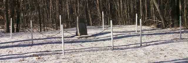
Site of the first house in Warren. Digital picture by Kenyon F. Karl on January 8, 2000
Just south of the trail bridge is a historical marker indicating the site of the first house in the Warren settlement.
On this site Joseph Patch built a hunters camp in September of 1767. A few weeks later he made this camp site into a more permanent cabin. Patch was then less than 21 years of age, was described as a "man of pleasing countenance and very agreeable in conversation. Thus it was here that the first house in the town of Warren was built. [text of brass plaque on the site]
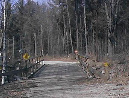
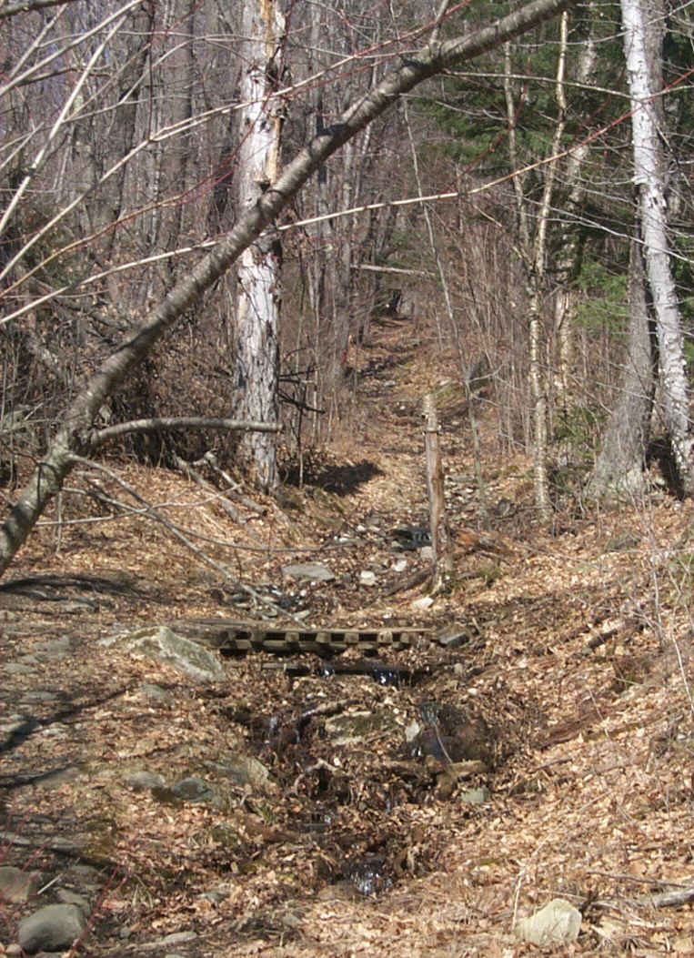
Trail bridge linking Red Oak Hill Road and Fish Hatchery Road. Digital picture by Kenyon F. Karl on April 6, 1999.
The trail then continues on Fish Hatchery Road across another brook to the edge of the Fish Hatchery grounds. The trail then turns diagonally across the meadow to cross Route 25 at the highway entrance to the Warren Fish Hatchery.
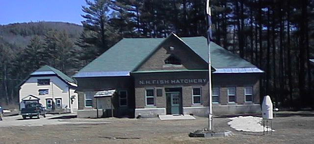
The Warren Fish Hatchery & Wildlife Center. Digital picture by Kenyon F. Karl on April 6, 1999.
The trail runs on a bank alongside the west side of the highway for very short distance and then turns gently into the old railroad bed as the highway swings away. After a short stretch, the trail crosses the Baker River on a newly constructed trail bridge.
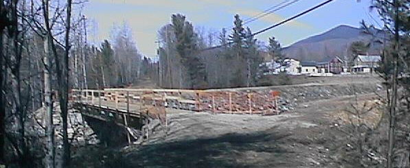
New trail bridge across the Baker River. Digital picture by Kenyon F. Karl on April 6, 1999.
A short distance north the trail swerves off of the railroad bed and dips to cross Chase Avenue before returning to the railroad bed. A small waterfall is located nearby.
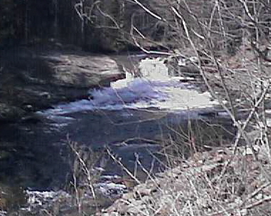
A small waterfall adjacent to the Chase Avenue crossing. Digital picture by Kenyon F. Karl on April 6, 1999.
The trail continues north behind the houses that line Main Street until it reaches the Warren Depot, currently used by the Messalonskee Health Center.
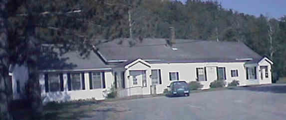
The Mooseulaukee Health Center in the former Depot. Digital picture by Kenyon F. Karl on May 27, 1998.
The rear of the Mooseulaukee Health Center. Digital picture by Kenyon F. Karl on May 27, 1998.
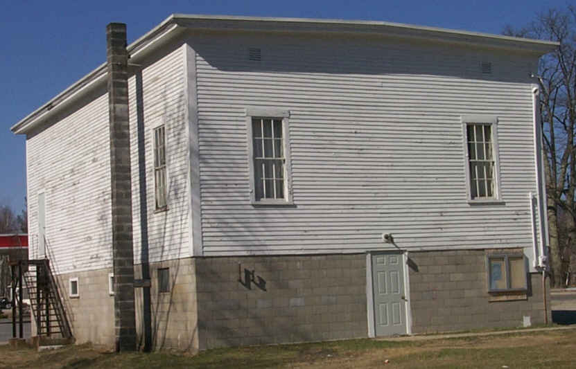
The Masonic Temple occupies what was once the railroad Freight House. Digital picture by Kenyon F. Karl on April 13, 2000.
The trail then swerves down along the river to run behind the Warren Village Market and returns to the railroad bed just north of the Market, and crosses Route 25C just east of the Warren Post Office. The trail then continues a short distance parallel to Route 25 until it passes the town hall. The trail then crosses a town street to pass the northwest corner of the town common, a displayed war missile, and the Warren Historical Society building.
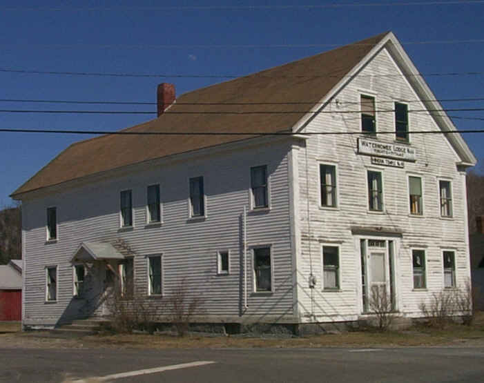
The Waternomee lodge at the southeast corner of the Common. Digital picture by Kenyon F. Karl on April 13, 2000.
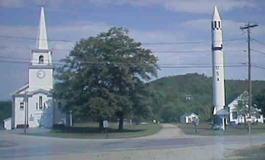
Warren Trailhead at the Town Common. Digital picture by Kenyon F. Karl on May 27, 1998.
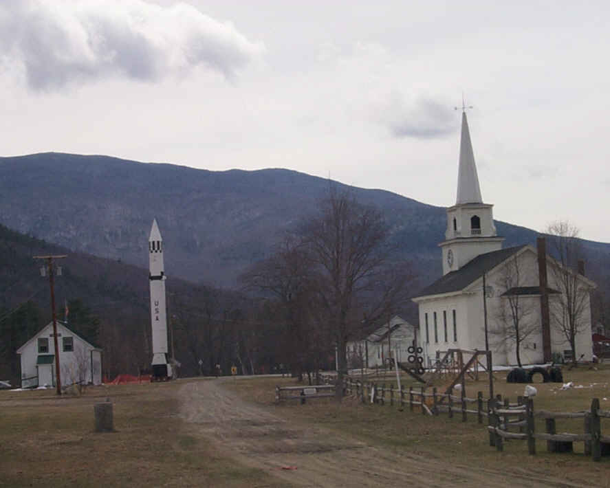
Looking back at the Warren Trailhead at the Common. Digital picture by Kenyon F. Karl on April 11, 2000
The trail continues north beside the missile and turns northwest parallel to the Lake Tarleton Road (Route 25C) for a short distance to bypass a hill then swings northwest to pass Swain Hill on its West side enroute to Glencliff Station.
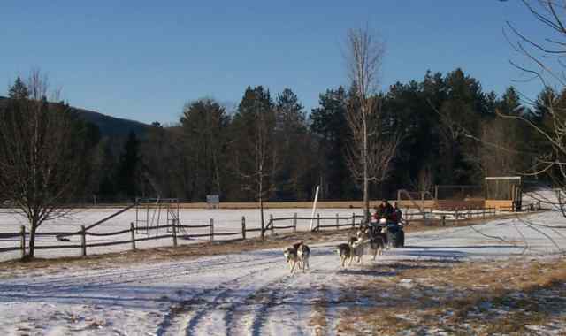
A sled dog racing team returning to the Warren Historical Society after a training run to Glencliff and return. Digital picture by Kenyon F. Karl on January 8, 2000.
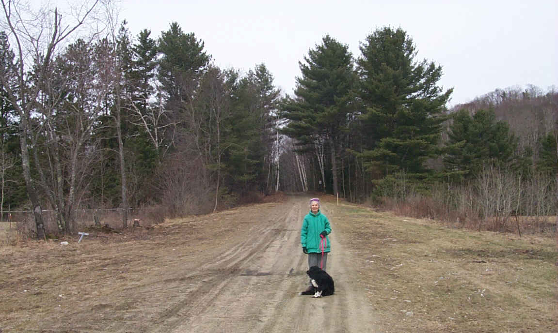
A local Senior Citizen getting her daily exercise on the Rail-trail. Digital picture by Kenyon F. Karl on April 11, 2000.
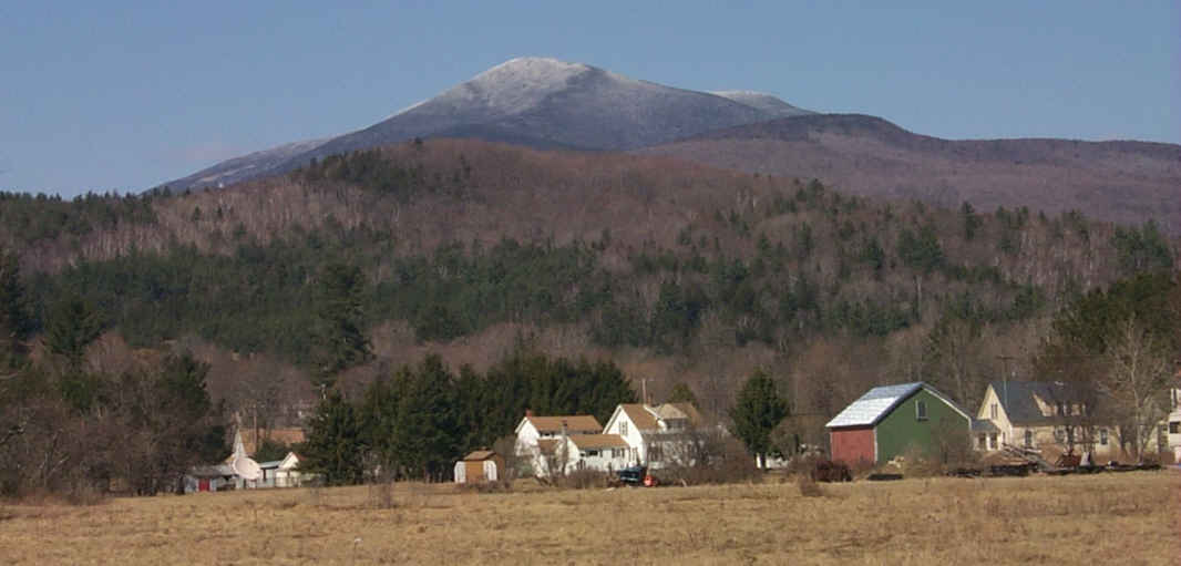
Mt. Mooseulaukee can be seen on the right as the trail leaves Warren. Digital picture by Kenyon F. Karl on April 13, 2000.
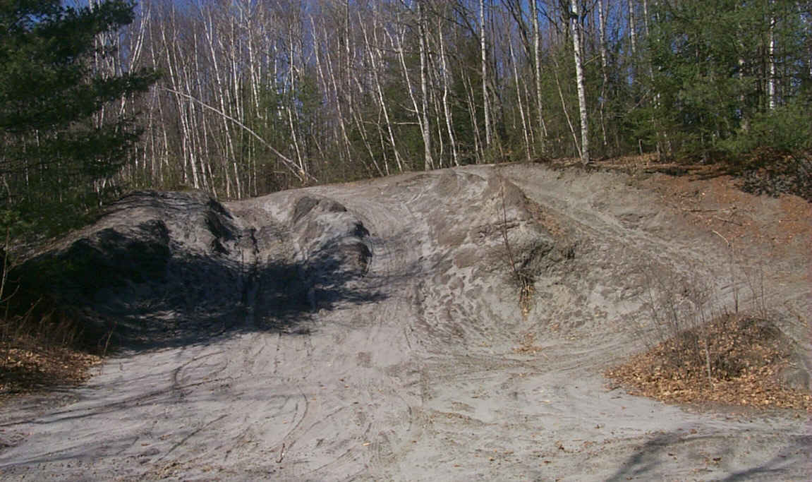
Evidence of a mica mine alongside the trail a short distance north of Warren. Digital picture by Kenyon F. Karl on April 13, 2000.
The old stagecoach road descends a hill to cross the trail a mile or so north of Warren. Digital picture by Kenyon F. Karl on April 13, 2000.
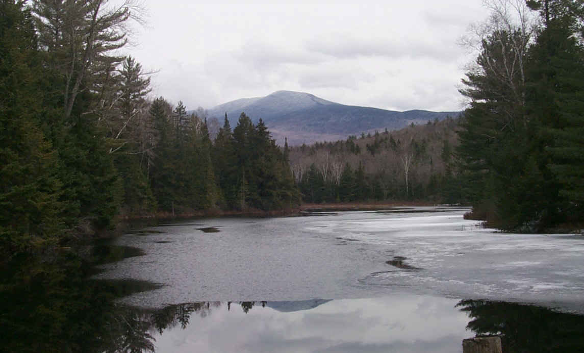
Mt. Mooseulaukee from the old mill pond near Weeks Crossing. This pond is about a quarter-mile west of the rail-trail, from a dirt road crossing about two miles north of Warren. Digital picture by Kenyon F. Karl on April 11, 2000.
 An undesignated
bike route is available between Warren and Plymouth over
the following town roads:
An undesignated
bike route is available between Warren and Plymouth over
the following town roads:


 The Scenic View
Campground is located a quarter-mile south of the
Fish Hatchery of the opposite side of Route 25. Note that the campground is open
for winter camping. A laundromat is located at the north end of the campground facing
Route 25 that is open from 8am to 8pm daily on a self-service basis. A toilet is
at the back of the laundromat. A public phone has been placed in an outdoor
booth next to the front door so that it is available on a 24 hour basis. An ice cream stand located next to the laundromat is open on a seasonal basis. Picnic
tables and drinking water (upon request) are presumably available to
customers of the ice
cream stand.
The Scenic View
Campground is located a quarter-mile south of the
Fish Hatchery of the opposite side of Route 25. Note that the campground is open
for winter camping. A laundromat is located at the north end of the campground facing
Route 25 that is open from 8am to 8pm daily on a self-service basis. A toilet is
at the back of the laundromat. A public phone has been placed in an outdoor
booth next to the front door so that it is available on a 24 hour basis. An ice cream stand located next to the laundromat is open on a seasonal basis. Picnic
tables and drinking water (upon request) are presumably available to
customers of the ice
cream stand.
 The Carr
Mountain Trail begins just south of the Warren Fish Hatchery. A
complete description of this trail is available in the AMC White
Mountain Guide sold by the Appalachian
Mountain Club. This trail passes a 0.2 mile side trail to
Waternomee Falls at 1.7 miles, then climbs to the top of Carr
Mountain in 3.6 miles, then continues to the Stinson Lake Road. Note
however that the 1998 version of the Trail Guide states
that the Warren end of the trail is no longer being maintained
and thus may be very hard to follow!
The Carr
Mountain Trail begins just south of the Warren Fish Hatchery. A
complete description of this trail is available in the AMC White
Mountain Guide sold by the Appalachian
Mountain Club. This trail passes a 0.2 mile side trail to
Waternomee Falls at 1.7 miles, then climbs to the top of Carr
Mountain in 3.6 miles, then continues to the Stinson Lake Road. Note
however that the 1998 version of the Trail Guide states
that the Warren end of the trail is no longer being maintained
and thus may be very hard to follow!


 The Warren Fish
Hatchery is open to the public between 8 am and 4 pm
on a seven day per week basis. The grounds also feature a display
pool containing several popular species of fish, as well as a
Wildlife Information Center (white building) that features
several stuffed wild animals in natural settings. Handicap accessible toilets,
and water are available at the
Wildlife Information Center building, and a handicap accessible picnic shelter
is nearby. Note that the buildings and grounds are closed at 4 pm daily. Ample
trail parking is presumably available along the town road just outside of the
fence that surrounds the grounds.
The Warren Fish
Hatchery is open to the public between 8 am and 4 pm
on a seven day per week basis. The grounds also feature a display
pool containing several popular species of fish, as well as a
Wildlife Information Center (white building) that features
several stuffed wild animals in natural settings. Handicap accessible toilets,
and water are available at the
Wildlife Information Center building, and a handicap accessible picnic shelter
is nearby. Note that the buildings and grounds are closed at 4 pm daily. Ample
trail parking is presumably available along the town road just outside of the
fence that surrounds the grounds.
 The town library is
located in a red brick building on the main street of the village about an
eighth of a mile south of the former railroad station.
The town library is
located in a red brick building on the main street of the village about an
eighth of a mile south of the former railroad station.
A picnic table was noted at the rear of the Mooseulaukee Health Center (former railroad
station). Because of its location, trail users must gracefully
give priority in usage of the table to the staff of the Health Center!

 The Warren Village
Market is just north of the Warren Depot. Toilets and water are
presumably available upon request at the Market during business
hours. Cold sandwiches, snacks, cold soda, and hot coffee are
usually available during the hours that the store is open for
business. The public phone is outside and thus available at all times.
The Warren Village
Market is just north of the Warren Depot. Toilets and water are
presumably available upon request at the Market during business
hours. Cold sandwiches, snacks, cold soda, and hot coffee are
usually available during the hours that the store is open for
business. The public phone is outside and thus available at all times.
 The Warren Post Office is located on Route 25C just
west of the Rail-trail.
The Warren Post Office is located on Route 25C just
west of the Rail-trail.
 A pizza parlor is across Route 25C from the Post Office. Toilets
and water are presumably available upon request at the pizza
parlor.
A pizza parlor is across Route 25C from the Post Office. Toilets
and water are presumably available upon request at the pizza
parlor.
A restaurant is located on the common across from the missile.
Toilets and water are presumably available upon request at the restaurant.
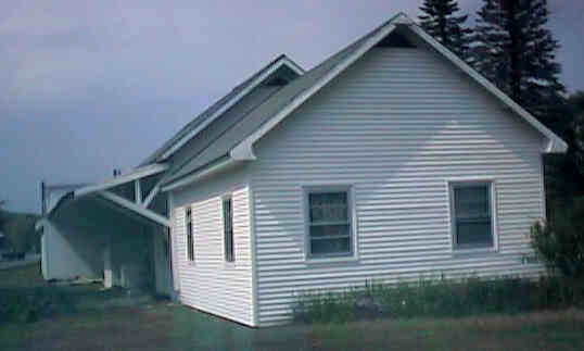
 The
Warren Historical Society is located in the small white building near the
missile. The building is open on a scheduled basis on Sunday
afternoons between April and October and otherwise upon request
during those months by calling the telephone numbers listed at
the entrance of the building. The parking area at the front of the building is
intended for the Historical Society and the adjacent Town Office Building. Limited
Trail Parking is thus located behind the small white
building. A chemical toilet was noted on April 13, 2000 several yards further
north along the trail for the obvious convenience of the users of the
adjacent baseball field.
The
Warren Historical Society is located in the small white building near the
missile. The building is open on a scheduled basis on Sunday
afternoons between April and October and otherwise upon request
during those months by calling the telephone numbers listed at
the entrance of the building. The parking area at the front of the building is
intended for the Historical Society and the adjacent Town Office Building. Limited
Trail Parking is thus located behind the small white
building. A chemical toilet was noted on April 13, 2000 several yards further
north along the trail for the obvious convenience of the users of the
adjacent baseball field.
Each location map on this Web Site is a link to a map on the Mapblast Web Site which in turn contains a link to a Business Directory of the surrounding area.
Sign images are from the Manual of Traffic Signs by Richard C. Moeur.
Updated on February 28, 2001 by Kenyon F.
Karl <[email protected]>.
Unintentional errors are likely!
