

Winter trail users must always be aware of the existence of steel rails under the snow cover. Indeed, these buried rails are particularly hazardous in the vicinity of switches, bridges, road and farm crossings!
|
|
![]() USGS
Topographic map of West Stewartstown
USGS
Topographic map of West Stewartstown
Railroad fans and the like must note that the railroad track has been buried under a layer of gravel in the center of West Stewartstown (surrounding the presumed location of the Depot) to allow the abutting property owners to use the dormant track bed for their own purposes. The local snowmobile club has created a rough bypass trail immediately west of that section of missing track.
Note also that the rail has been removed from the railroad bridge just north of the town to allow snowmobiles to cross the bridge on the old railroad ties. Because of the existence of large gaps between the railroad ties, this railroad bridge is obviously dangerous for all other trail users on a year-round basis! Note that these railroad rails have been piled near the bridge so that they can be restored if necessary for railroad usage!
Spot checks from the parallel highway and paved public road crossings on March 6, 2000 suggest that the railroad is otherwise intact in this area.
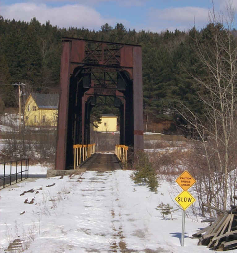
Railroad bridge across the Connecticut River just north of West Stewartstown. Digital photograph by Kenyon F. Karl on March 6, 2000.
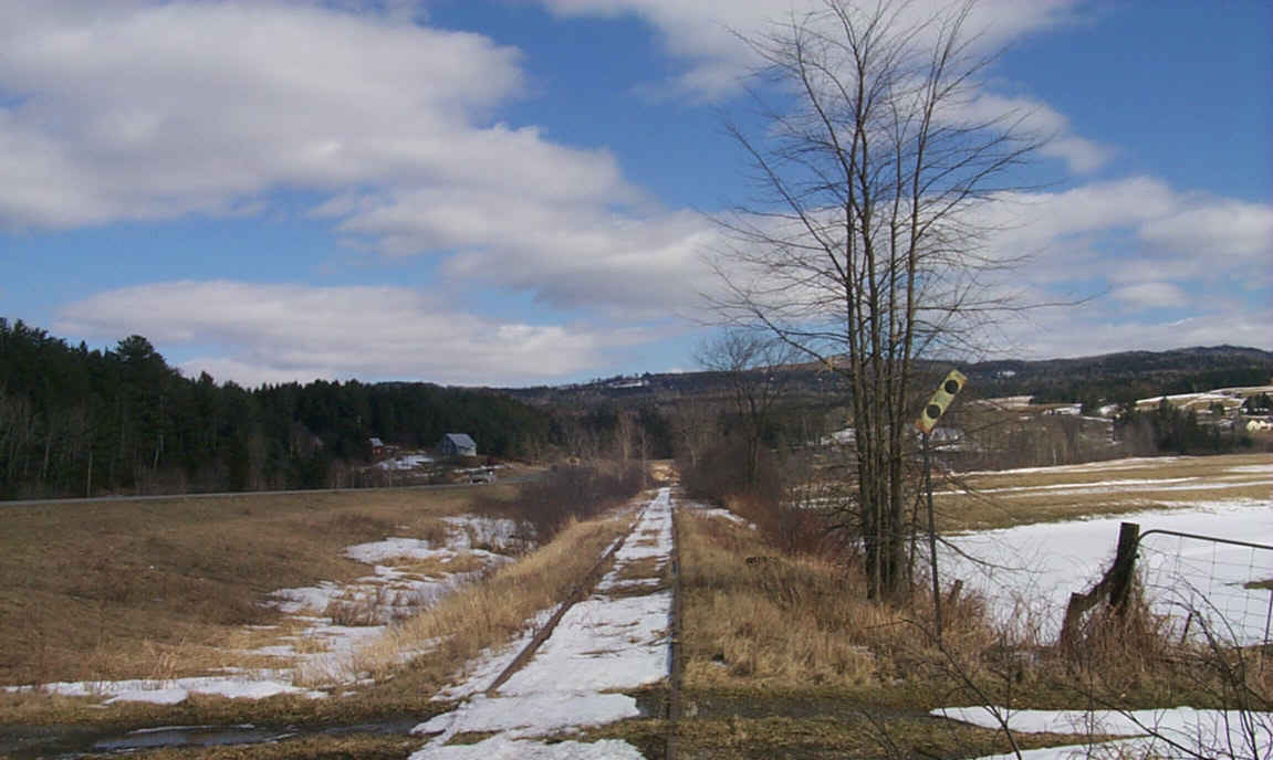
A typical section of rail-trail south of West Stewartstown. Digital photograph by Kenyon F. Karl on March 6, 2000.


 A gas station and convenience store is located just south of the presumed
location of the West Stewartstown railroad station, adjacent to the rail-trail
at the Route 3
overpass. Limited groceries and limited food service is available. A chemical
toilet unit is outside the south wall of the building near the rail-trail. A
public phone is outside facing the street.
A gas station and convenience store is located just south of the presumed
location of the West Stewartstown railroad station, adjacent to the rail-trail
at the Route 3
overpass. Limited groceries and limited food service is available. A chemical
toilet unit is outside the south wall of the building near the rail-trail. A
public phone is outside facing the street.
 The Webmaster noticed in passing on March 6, 2000 that the parking area had been
plowed at the highway rest area and information center on Route 3 between West
Stewartstown and Colebrook. A quick look suggests that the facility was
otherwise closed during the winter. Furthermore, there was no obvious evidence
of a short connecting trail to the rail-trail a short distance away from the
opposite side of the highway!
The Webmaster noticed in passing on March 6, 2000 that the parking area had been
plowed at the highway rest area and information center on Route 3 between West
Stewartstown and Colebrook. A quick look suggests that the facility was
otherwise closed during the winter. Furthermore, there was no obvious evidence
of a short connecting trail to the rail-trail a short distance away from the
opposite side of the highway!
 Listed on the National Register
of Historic Places:
Listed on the National Register
of Historic Places:
Jacobs Stand W. Park St. Canaan, VT
Sign images are from the Manual of Traffic Signs by Richard C. Moeur.
Updated on March 01, 2001 by Kenyon F.
Karl <[email protected]>.
Unintentional errors are likely!
