

|
|
![]() USGS
Topographic map of Wolfeboro
USGS
Topographic map of Wolfeboro
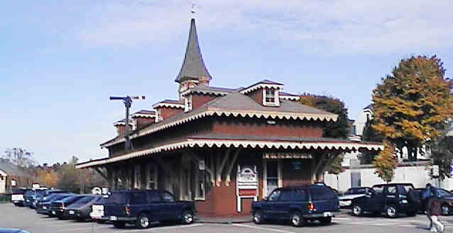
Former Wolfeboro Station. Digital photograph by Kenyon F. Karl on October 13, 1997.
An old postcard of the Wolfeboro Station is on the Wolfeboro Online Web Site.
The well maintained gravel footway of the Honorable Russell Chase Memorial Path totally replaces the railroad track beginning at the rear of the former Railroad Station, one block north of Main St.
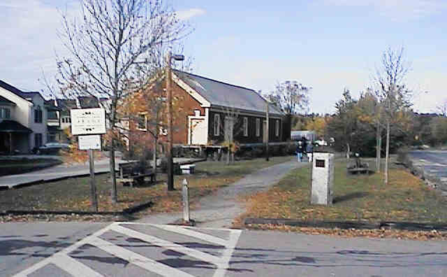
Former Wolfeboro Freight House. Digital photograph by Kenyon F. Karl on October 13, 1997.
The well maintained and lighted gravel path continues alongside the former Freight House.
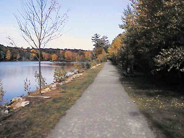
Along the shore of Back Bay. Digital photograph by Kenyon F. Karl on October 13, 1997.
This pleasant bayside section of the trail features benches for weary walkers.

Small rock cut at Back Bay. Digital photograph by Kenyon F. Karl on October 13, 1997.
This rock cut is near the midpoint of the trail to Wolfeboro Falls.


 Public Parking
surrounds the Railroad Station. Tourist Information is available at the Chamber
of Commerce Office at the front of the building. Public Toilets and a water
fountain can be found at the rear of the building.
Public Parking
surrounds the Railroad Station. Tourist Information is available at the Chamber
of Commerce Office at the front of the building. Public Toilets and a water
fountain can be found at the rear of the building.
 Several
restaurants of various kinds presumably exist in the area surrounding the
railroad station. Each restaurant presumably offers toilets and water upon
request.
Several
restaurants of various kinds presumably exist in the area surrounding the
railroad station. Each restaurant presumably offers toilets and water upon
request.
 MS Mount Washington
stops at the dock a quarter-mile south of the railroad station on a seasonal
basis as part of a circular tour of Lake Winnipesaukee.
MS Mount Washington
stops at the dock a quarter-mile south of the railroad station on a seasonal
basis as part of a circular tour of Lake Winnipesaukee.
Wolfeboro
Online provides a wide variety of tourist and business information for
the Wolfeboro area.
![]()
![]() Each map on this page is a link to a map on the Mapblast Web Site that in turn
contains a link to a Business Directory of the surrounding area.
Each map on this page is a link to a map on the Mapblast Web Site that in turn
contains a link to a Business Directory of the surrounding area.
 Listed on the National
Register of Historic Places:
Listed on the National
Register of Historic Places:Brewster Memorial Hall S. Main and Union Sts. Wolfeboro
Updated on February 26, 2001 by Kenyon F. Karl <[email protected]> using information collected on June 13, 1999. Unintentional errors are likely!
Sign images are from the Manual of Traffic Signs by Richard C. Moeur.

Live camera shots of Wolfeboro Landing and Downtown Wolfeboro are available at the Wolfeboro Online Web Site