

The Peterborough Bike Route is a paved bike trail that begins at the north driveway of the Noone Falls Mill (occupied by shops and offices) and runs parallel to the east side of Route 202 to the Grove Street crossing. The topography of the trail strongly suggests that it occupies an abandoned railroad bed despite the location of the railroad track symbol on the west side of the highway in the following location map.
Trail users should be able to thread their way through the parking lot of the Noone Falls Mill to its south end, where they can cross the bridge (closed to vehicle traffic) to the east side of the mill pond.
|
|
![]() USGS
Topo map of Peterborough Bike Path
USGS
Topo map of Peterborough Bike Path
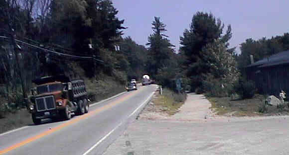
South end of Peterborough Bike Route at Noone Falls Mill. Digital picture by Kenyon F. Karl on July 15, 1998.
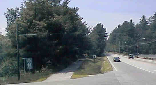
North end of Peterborough Bike Route at Grove Street. Digital picture by Kenyon F. Karl on July 15, 1998.
| Item | From | To | Year | RR | Miles |
|---|---|---|---|---|---|
| 290 | Jaffrey | Peterborough | 1972 | B&M | 5.5 |
| Name | Route | Number | Description | Years | Cost $(M) |
|---|---|---|---|---|---|
| Jaffrey | RR Corridor | 12706 | Purchase the abandoned RR corridor from Rindge to Peterboro, Construct Multi-use path [96-66TE] | C1999 | .325 |
| Peterboro | Riverwalk | 12680 | Construct Riverwalk to be used as a multi-use transportation pathway connecting businesses to outlying areas. | C2000 | .252 |
Years: R= Right-of-way acquisition, C=Construction
Sign images are from the Manual of Traffic Signs by Richard C. Moeur.
Updated on February 22, 2001 by Kenyon F.
Karl <[email protected]>.
Unintentional errors are likely!
