


|
|
![]() USGS
Topographic map of Boy Mtn.
USGS
Topographic map of Boy Mtn.
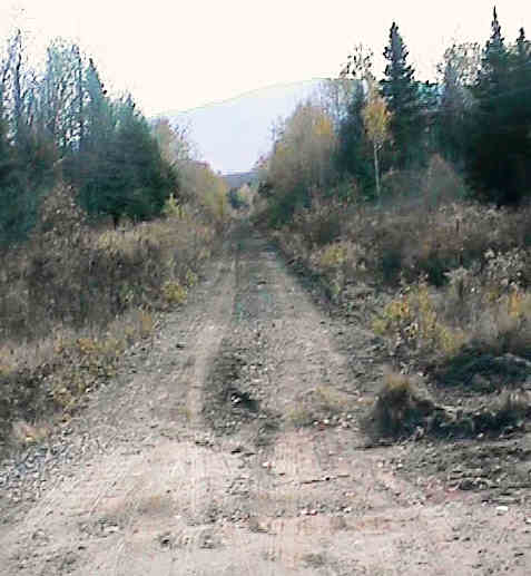
Lookng east from Jefferson Notch Road Crossing. Digital photograph by Kenyon F. Karl on October 23, 1997.
Mt. Madison can be seen in the distance. Boy Mountain can be seen by looking north from this point. This Station was apparently nothing more than a rural flag stop for the local residents!
Note that Valley Road is a lightly used gravel road at this point.
The Jefferson Notch Road is the recently re-opened steep and winding gravel road through the National Forest that eventually leads to the trailhead for the Caps Ridge Trail, and continues on to cross Base Road near the Cog Railway Base Station. As a lightly used road, it should be suitable for mountain bikes and equestrian usage. Because the Jefferson Notch Road is not plowed in winter, it should also be useful for adventurous x-c-skiers!
Mt. Clinton Road continues thereafter as a paved but still lightly used road which finally terminates at Route 302 a short distance north of Crawford Notch Station. Note that the Mt. Clinton Road is likewise not plowed in winter!
There are no observable public facilities in this area except for trail access at the road crossing!
Note that there is no direct route to the Boy Mountain Trail that begins from Route 2.
Sign images are from the Manual of Traffic Signs by Richard C. Moeur.
Updated on February 28, 2001 by Kenyon F.
Karl <[email protected]>.
Unintentional errors are likely!
