


The current text of the WMNF Lincoln Woods Trail guide as well as the corresponding cross-country ski guide has been posted to the WMNF Web Site to which potential trail users are directed for current information. What follows is merely supplementary information!
|
|
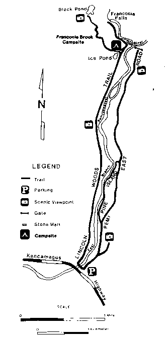
Note that the East Branch Road follows the east bank of the East Branch of the Pemigewasset River, while Rail-trail follows the west bank of the same river.
![]() USGS
Topographic map of Lincoln Woods Trailhead
USGS
Topographic map of Lincoln Woods Trailhead


 Ample parking, pit toilets, and a WMNF ranger staffed information desk is
available at the Lincoln Woods trailhead. Note that the parking
pass program applies to this parking area, with the exception of a
designated area with a 15 minute parking limit. Conversely, parking passes can
be purchased from the ranger on duty!
Ample parking, pit toilets, and a WMNF ranger staffed information desk is
available at the Lincoln Woods trailhead. Note that the parking
pass program applies to this parking area, with the exception of a
designated area with a 15 minute parking limit. Conversely, parking passes can
be purchased from the ranger on duty!
