


|
|
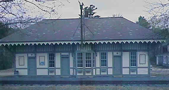
Potter Place Depot. Digital photograph by Kenyon F. Karl on April 27, 1998.
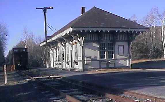
Potter Place Depot and Caboose. Digital photograph by Kenyon F. Karl on December 19, 1999.
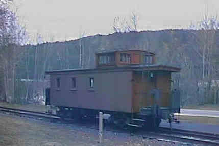
Old caboose at Potter Place Depot. Digital photograph by Kenyon F. Karl - April 27, 1998.
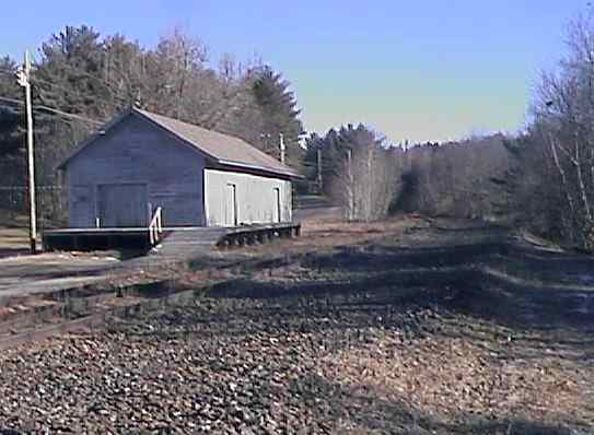
Potter Place Freight House. Digital photograph by Kenyon F. Karl on December 19, 1999.
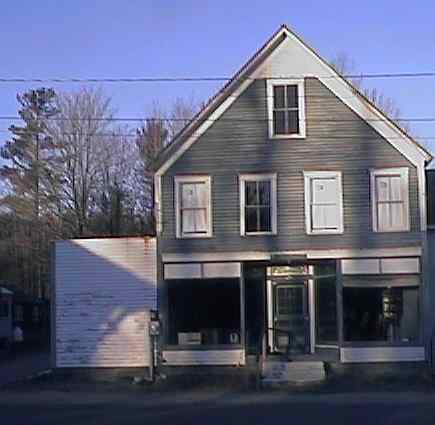
Old Potter Place Post Office and General Store. Digital photograph by Kenyon F. Karl on December 19, 1999.

 The Potter Place Station building is owned and
operated by the Andover Historical Society as a small museum
featuring a variety of artifacts from both the railroad and the
town. The display includes the restored Victorian railroad
station building and a wooden caboose on a short stretch of
preserved railroad track adjacent to the station
platform. The Andover Historical Society is also restoring a combination general
store and post office cross the street, from the Station. Note that the Historical society is not connected with
any rail-trail organization. The Historical Society is open (on a seasonal
basis?) on Saturday between 10 am and 3 pm and on Sunday between 1 pm and 3 pm
and otherwise by special arrangement (call 603-735-5628).
The Potter Place Station building is owned and
operated by the Andover Historical Society as a small museum
featuring a variety of artifacts from both the railroad and the
town. The display includes the restored Victorian railroad
station building and a wooden caboose on a short stretch of
preserved railroad track adjacent to the station
platform. The Andover Historical Society is also restoring a combination general
store and post office cross the street, from the Station. Note that the Historical society is not connected with
any rail-trail organization. The Historical Society is open (on a seasonal
basis?) on Saturday between 10 am and 3 pm and on Sunday between 1 pm and 3 pm
and otherwise by special arrangement (call 603-735-5628).
 Limited
parking should be available adjacent to the Railroad Depot, except
when
the Museum is open to the public.
Limited
parking should be available adjacent to the Railroad Depot, except
when
the Museum is open to the public.

 A sign indicates that the Potter Place Inn is open for Lodging and Fine Dining.
 The Cilleyville
Bridge (Covered Bridge #16) is about 0.9 miles southwest of Potter Place via Cilleyville
Road. Because of its tragic condition, the bridge is closed even to
pedestrian traffic. Accordingly, the nearby Mill Street must be used to reach the other
end of the bridge!
The Cilleyville
Bridge (Covered Bridge #16) is about 0.9 miles southwest of Potter Place via Cilleyville
Road. Because of its tragic condition, the bridge is closed even to
pedestrian traffic. Accordingly, the nearby Mill Street must be used to reach the other
end of the bridge!


 A convenience store on Route 11 near the Cilleyville Bridge offers coffee, cold
drinks, and other refreshments as well as limited groceries. Toilet facilities
and drinking water are presumably available upon request. The suggested route
from Potter Place Depot for 'street legal' trail users is via Cilleyville Road
and Mill Street to a point almost across the highway from the store.
A convenience store on Route 11 near the Cilleyville Bridge offers coffee, cold
drinks, and other refreshments as well as limited groceries. Toilet facilities
and drinking water are presumably available upon request. The suggested route
from Potter Place Depot for 'street legal' trail users is via Cilleyville Road
and Mill Street to a point almost across the highway from the store.
The trail map at the Andover
Snowmobile Club Web Site shows a snowmobile trail to Winslow State Park
and Mt Kearsarge Mountain from a point a short distance east of Potter Place
station.
 The following Statewide
Bicycle Routes are available on the adjacent highways:
The following Statewide
Bicycle Routes are available on the adjacent highways:
Rte. 4 to Boscawen and Concord
Rte. 11 to New London and Claremont
Rte. 4A to Lebanon
Any Mapblast Map on this Web Site is a link to the Mapblast Web Site which in turn leads to a Business Directory of the surrounding area.
Sign images are from the Manual of Traffic Signs by Richard C. Moeur.
Updated on February 14, 2001 by Kenyon F.
Karl <[email protected]>.
Unintentional errors are likely!
