

Winter trail users must always be aware of the existence of steel rails under the snow cover. Indeed, these buried rails are particularly hazardous in the vicinity of switches, bridges, road and farm crossings!
|
|
![]() USGS
Topographic map of Colebrook
USGS
Topographic map of Colebrook
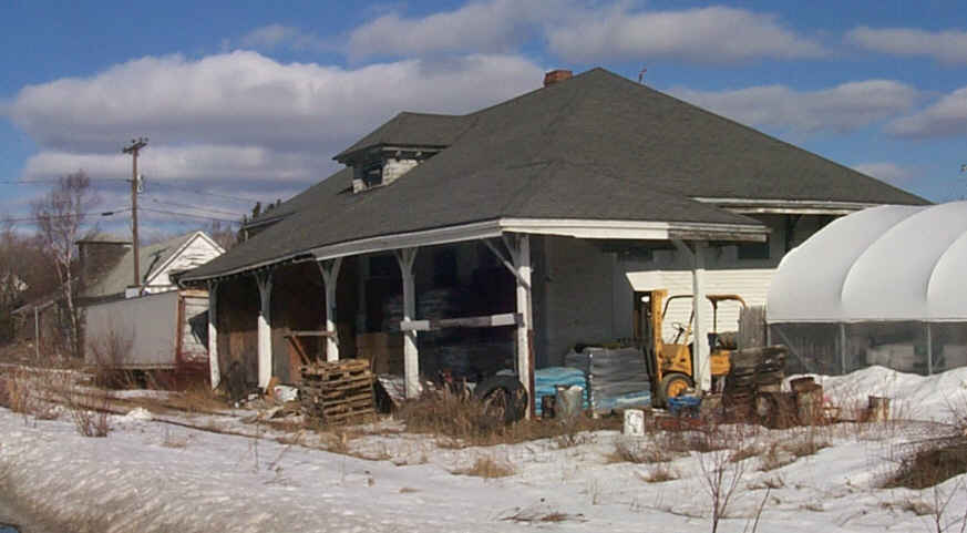
Former Colebrook railroad station. Digital photograph by Kenyon F. Karl on March 6, 2000.
Potential trail users must note that there was no snowmobile trail signs or other any other evidence of snowmobile usage south of Bridge Street in Colebrook to Columbia Bridge on March 6, 2000!
About 50 feet of rail has been removed at the site of a switch just south of Bridge Street in Colebrook. Spot checks from the parallel highway and paved public road crossings on March 6, 2000 suggest that the railroad is otherwise intact in this area.
 Trail parking is
available at the municipal parking lot near the Route 3 river bridge at the
north end of the commercial district of Colebrook. A short spur trail runs along
the river bank to the
rail-trail.
Trail parking is
available at the municipal parking lot near the Route 3 river bridge at the
north end of the commercial district of Colebrook. A short spur trail runs along
the river bank to the
rail-trail.
 A
snowmobile trail runs south along Route 3 from the municipal parking lot to the
gas station between Bridge and Colby Streets!
A
snowmobile trail runs south along Route 3 from the municipal parking lot to the
gas station between Bridge and Colby Streets!


 Restaurants and stores of various kinds must be located in the commercial
district of Colebrook along Route 3 between the municipal
parking lot and Colby Street. Unfortunately, the Webmaster failed to note the
specific location of these facilities during the trail check performed on March
6, 2000. Toilets and water are presumably available upon
request in the restaurants, the gas station, and many of the other stores in
this commercial district.
Restaurants and stores of various kinds must be located in the commercial
district of Colebrook along Route 3 between the municipal
parking lot and Colby Street. Unfortunately, the Webmaster failed to note the
specific location of these facilities during the trail check performed on March
6, 2000. Toilets and water are presumably available upon
request in the restaurants, the gas station, and many of the other stores in
this commercial district.
Sign images are from the Manual of Traffic Signs by Richard C. Moeur.
Updated on March 01, 2001 by Kenyon F.
Karl <[email protected]>.
Unintentional errors are likely!
