
Laying out the road in 1759. Scanned from the 1998 Crown Point Association Program Card.

click on map for oversized image!
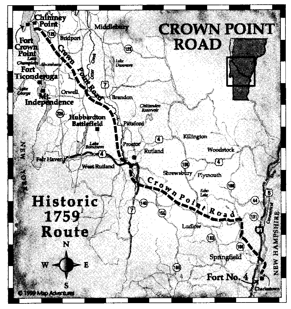
1759 route of the Crown Point Road. Scanned from the 2001 Crown Point Association Program Card.
The Crown Point Road, which crossed the Vermont frontier, was constructed by the order of British General Amherst in 1759 during the French and Indian War to connect Fort No. 4 on the Connecticut River to Fort Crown Point on Lake Champlain. It was then used to supply British forces with arms, men and provisions and afterwards served American troops during the Revolution. Following the cessation of hostilities, the road played an integral role in the settlement of Vermont. Based upon the original layout of the road and a network of secondary roads, Vermont's first settlements began to appear.
The Crown Point Road Association, a non-profit organization, was formed in 1958 by a group of people interested in commemorating the 200th anniversary (1959) of the construction of the old military road. The Association gained support and interest and still continues its mission to research, mark and preserve the history of Vermont's first road.
Each summer hikes are conducted on various sections of the road. Members and the general public are invited to enjoy the outdoors and learn about the hardships and dedication of the road builders. Original bridges, stone abutments, grave sites, camp sites and abandoned cellar holes give mute testimony to the courage and determination of our ancestors. The Association hopes to encourage public awareness of the legacy these pioneers left our country and our state. Membership is invited.
 Listed on the National
Register of Historic Places:
Listed on the National
Register of Historic Places:Historic Crown Point Road Off VT 131 Weathersfield
Add Language Translation to your browser from the Babel Fish Tool page from AltaVista: