


|
|
![]() USGS
Topo map of Webster Place
USGS
Topo map of Webster Place
Webster Place appears to be nothing more than a rural train stop for the adjacent Sisters of the Holy Cross Convent. Note that this convent was apparently built around the historic Daniel Webster Family Home. The totally illegible signboard for this stop still exists just south of the crossing!
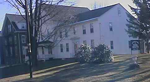
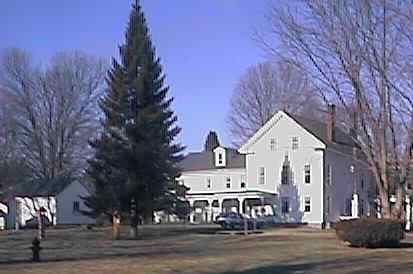
Front and back views of the Mansion Home of Daniel Webster (1800-1852) on the grounds of the Sisters of the Holy Cross Convent. Digital Photographs by Kenyon F. Karl on December 18, 1999.
Trail access is available at the following points:
A farm crossing a short distance south of Webster Place Station
Sisters of Holy Cross Rd (at Webster Place Station)
Doucette Drive a quarter-mile north of Webster Place Station

 The farm crossing a short distance south of Webster Place is across the highway
from an entrance road to a large commercial campground that is open during
the warm weather months.
The farm crossing a short distance south of Webster Place is across the highway
from an entrance road to a large commercial campground that is open during
the warm weather months.
Any Mapblast Map on this Web Site is a link to the Mapblast Web Site which in turn leads to a Business Directory of the surrounding area.
 Listed on the
National Register
of Historic Places:
Listed on the
National Register
of Historic Places: 