


|
|
![]() USGS
Topographic map of Grafton
USGS
Topographic map of Grafton
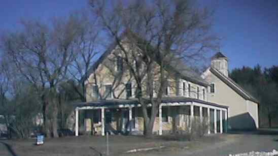
The former Grafton Inn is located across the highway near the site of Grafton Station. Digital photograph by Kenyon F. Karl on December 19, 1999.
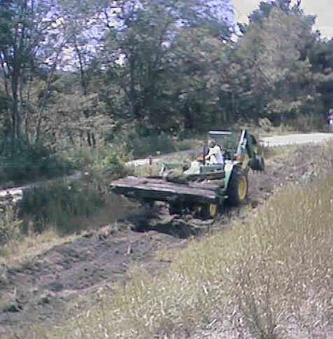
A volunteer removing ties from the trail surface in Grafton. Digital picture by Kenyon F. Karl on July 25, 1998.
Simple Trail access is available at the following road crossings:
Sargent Hill Road, about 0.8 miles east of Grafton Station.
A private road crossing a short distance east of Grafton Station (to adjacent Route 4 only).
Williams Hill Road about 0.3 miles west of Grafton Station.
 US Route 4 is a Statewide
Bicycle Route that roughly parallels the Rail-trail between Danbury and Lebanon.
Each of the following trail access points thus forms a short connecting link to
the Bike Route.
US Route 4 is a Statewide
Bicycle Route that roughly parallels the Rail-trail between Danbury and Lebanon.
Each of the following trail access points thus forms a short connecting link to
the Bike Route.
Sargent Hill Road, about 0.8 miles east of Grafton Station.
A private road crossing a short distance east of Grafton Station .
Williams Hill Road about 0.3 miles west of Grafton Station.


 Limited groceries and food service, snacks and gasoline are available within the Grafton General Store,
across the highway and a short distance east of Grafton Station. Water is available upon request inside.
The store is open M-Thu 6am to 9pm, F & Sat 6am to 10pm, Sun 6:30am to
8:30pm.
A public phone is located outside in front of the building. The
front porch of the building can be used as a small trail shelter.
Limited groceries and food service, snacks and gasoline are available within the Grafton General Store,
across the highway and a short distance east of Grafton Station. Water is available upon request inside.
The store is open M-Thu 6am to 9pm, F & Sat 6am to 10pm, Sun 6:30am to
8:30pm.
A public phone is located outside in front of the building. The
front porch of the building can be used as a small trail shelter.
Note that the nearby Liberty Rock Store is permanently closed.
 Limited trail
parking may be available on an informal basis between the trail and the highway across from the
Grafton General Store.
Limited trail
parking may be available on an informal basis between the trail and the highway across from the
Grafton General Store.
 The town library is located on
Library Street which begins beside the Grafton General Store.
The town library is located on
Library Street which begins beside the Grafton General Store.

 The
town recreation field is a short distance south of the trail via
the crossroad just west of Grafton Station. Limited trail parking should be available
whenever field is not in use. A picnic table is
near the road. A chemical toilet may be present during the spring,
summer and fall sports seasons just beyond a small building at
the far southeast corner on the field.
The
town recreation field is a short distance south of the trail via
the crossroad just west of Grafton Station. Limited trail parking should be available
whenever field is not in use. A picnic table is
near the road. A chemical toilet may be present during the spring,
summer and fall sports seasons just beyond a small building at
the far southeast corner on the field.


 The Post Office, Fire/Ambulance
Station, Police Department, and a new building for the Historical
Society are adjacent to each other on Route 4, a short distance west of Grafton
Station.
The Post Office, Fire/Ambulance
Station, Police Department, and a new building for the Historical
Society are adjacent to each other on Route 4, a short distance west of Grafton
Station.
Sign images are from the Manual of Traffic Signs by Richard C. Moeur.
Updated on February 14, 2001 by Kenyon F.
Karl <[email protected]>.
Unintentional errors are likely!
