


Road construction just east of Tewksbury Lake in Grafton (west of Cardigan Station) has forced the closure of the trail between Bullocks Crossing Road and Summit Siding in the summer & fall of 2000. A detour sign was noted for westbound trail users suggesting a detour route via Bullocks Crossing Road, Tunnel Road, and Razor Hill Road; and similar signs has been posted for eastbound trail users at a short but rough access road to summit siding that suggest the same route in the opposite direction.
|
|
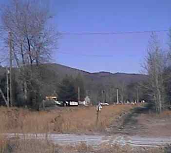
Site of Cardigan Station. Digital photograph by Kenyon F. Karl on December 19, 1999.
Granite stones that were used as the edge of the station platform have been found a few feet west of the driveway that runs alongside the playground next to the church building.
A typical New England meeting house is located just east of the site of Cardigan Station. Note that the Rail-trail runs directly behind the meeting house. A typical New England Town Common is cross the highway from the meeting house. The other three sides of the common is lined with old houses. One building obviously once contained the general store.
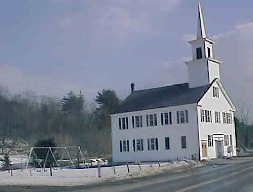
Meeting House at Grafton Center . Digital picture by Kenyon F. Karl on March 4, 1998.
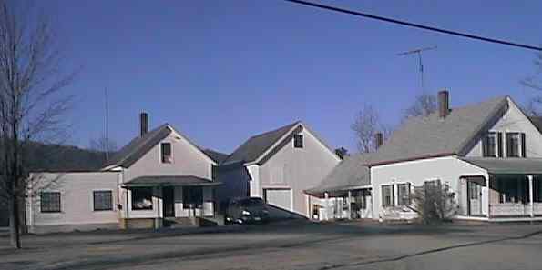
A New England Farmhouse with attached barn adjacent to what had once been the general Store. Digital photograph by Kenyon F. Karl on December 19, 1999.
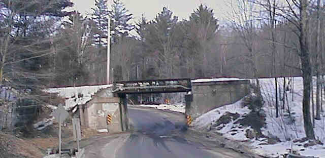
Highway underpass near Tunnel Road. Digital picture by Kenyon F. Karl on March 4, 1998.
The railroad overpass west of Cardigan Station near the west end of Tunnel Road. This underpass is narrow and low, and positioned in the middle of a sharp 'S' curve. Accordingly, the NH Department of Transportation proposes to remove the underpass and/or otherwise realign the highway so that it meets current highway standards. [Project #12522 (Grafton Betterment)]. The current proposal is to construct a new section of US Route 4 to cross the railroad bed at grade a short distance south of the underpass. However, trail will be diverted to use a trail underpass to avoid the dangers to trail users of crossing the busy highway.
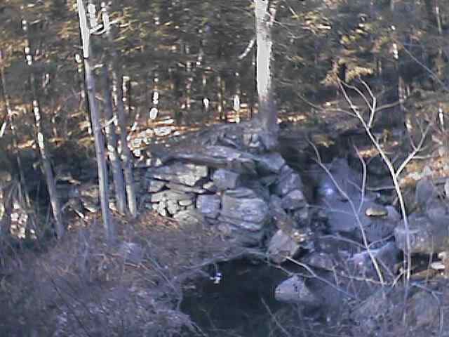
Abandoned mill dam adjacent to railroad overpass. Digital photograph by Kenyon F. Karl on December 19, 1999.
A long forgotten but historic mill dam is located near the northwest corner of the railroad overpass. However, trail users may be limited to looking at the dam from the height that railroad overpass.
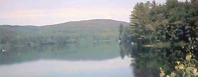
Tewsbury Pond. Digital picture by Kenyon F. Karl on July 4, 1998.
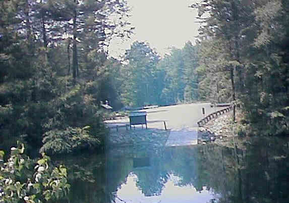
Tewsbury Pond Boat Launching Area. Digital picture by Kenyon F. Karl on July 4, 1998.
The rail-trail then crosses the Smith River twice within a short distance, then runs along the north shore of Tewksbury Pond. Just north of the second river bridge (just a brook at this point) is an unoccupied area of the shoreline that might be suitable as very primitive picnic area. This area is right across the neck of the pond from the boat launching area, however the parking and toilet facilities that are easy to see across the end of the pond are totally out of reach because of the absence of a suitable connecting trail!
No trail facilities were observed in this section of the trail!
Simple trail access is available at the following road crossings:
 US Route 4 is a Statewide
Bicycle Route that roughly parallels the Rail-trail between Danbury and Lebanon.
Each of the following trail access points thus forms a short connecting link to
the Bike Route.
US Route 4 is a Statewide
Bicycle Route that roughly parallels the Rail-trail between Danbury and Lebanon.
Each of the following trail access points thus forms a short connecting link to
the Bike Route.
 Ruggles Mine
is located at the top of Isinglass Mountain, about 2.7 miles from
Cardigan Station. The well marked route to the mine begins on
paved town roads that lead from the eastern end of the Common,
and continues almost flat across the valley. Beginning at the red
gates, a private road leads steeply to a parking lot at the top
of the mountain that offers a spectacular view of Mt. Cardigan
and the intervening valley. Refreshments, toilets, and water are available in
the gift shop at the mine entrance. There is no charge for the use of the
parking lot and gift shop facilities, but a moderate admission charge applies for entrance to the
mine itself. Note that this commercial attraction is open only on a seasonal basis!
Ruggles Mine
is located at the top of Isinglass Mountain, about 2.7 miles from
Cardigan Station. The well marked route to the mine begins on
paved town roads that lead from the eastern end of the Common,
and continues almost flat across the valley. Beginning at the red
gates, a private road leads steeply to a parking lot at the top
of the mountain that offers a spectacular view of Mt. Cardigan
and the intervening valley. Refreshments, toilets, and water are available in
the gift shop at the mine entrance. There is no charge for the use of the
parking lot and gift shop facilities, but a moderate admission charge applies for entrance to the
mine itself. Note that this commercial attraction is open only on a seasonal basis!
Ruggles Mine a gem since 1803 (July 22, 2001 - Citizen)
An undesignated
bike route about 5.2 miles in length to the Grafton
Pond Reservation begins at the site of Cardigan Station.
Sign images are from the Manual of Traffic Signs by Richard C. Moeur.
Updated on July 23, 2001 by Kenyon F.
Karl <[email protected]>.
Unintentional errors are likely!
