

The rail-trail is owned by the City of Keene north of Route 12. The City Planning Office should have plans for a crossing of Route 12 in coordination with the NH-DOT plan to reconstruct the Keene Bypass Highway.
Pathways for Keene is responsible for fund-raising and volunteer support for these plans.
Local coordination is provided by:
Friends of Pisgah


|
|
Spot-checks performed on July 6, 1998 suggests that the Asheulot Branch is usable south of the Route 10 - 12 - 101 highway crossing.


 Keene
Bypass highway (Rte 12) is
so busy that any attempt to cross the highway at the trail
crossing is extremely hazardous!
Keene
Bypass highway (Rte 12) is
so busy that any attempt to cross the highway at the trail
crossing is extremely hazardous!
A short length of the trail is usable from the north edge of the Keene Bypass Highway (Routes 10/12/101), across the Asheulot River to the intersection of Winchester and Foundry Streets. Bridge Decking and adjacent rail-trail conversion was reportedly performed by Keene State College so that the college students could easily walk across the river to the college athletic fields.
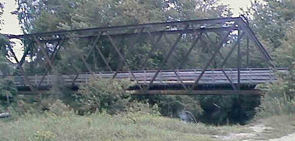
Asheulot Branch Bridge over the Asheulot River in Keene. Digital photograph by Kenyon F. Karl on July 6, 1998.
The paved surface of Foundry Street can then be used to reach another short section of rail-trail to reach the shopping center complex at Emerald Street. However trail users must traverse the shopping center parking lots northeasterly to reach the bike path at School Street that runs to Keene Depot.
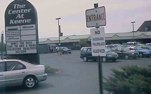
The shopping center that faces Emerald Street in Keene. Digital photograph by Kenyon F. Karl on July 6, 1998


 A short side trail leaves at the south
end of the Asheulot River Bridge and heads west around the
buildings to the front of the adjacent shopping center. This
shopping center and the commercial strip across Winchester Street
contains several restaurants of various kinds, where toilets and
water are presumably available upon request. A major
grocery store may also be located in this area, although its existence was not specifically noted during the spot-check on
July 6, 1998.
A short side trail leaves at the south
end of the Asheulot River Bridge and heads west around the
buildings to the front of the adjacent shopping center. This
shopping center and the commercial strip across Winchester Street
contains several restaurants of various kinds, where toilets and
water are presumably available upon request. A major
grocery store may also be located in this area, although its existence was not specifically noted during the spot-check on
July 6, 1998.
The shopping center located between
Emerald and Gilbo Streets contains a public toilet near its east
end. A pizza shop and Chinese restaurant are located at the
northwest corner of the site, where toilets and water are
presumably also available upon request.
 City
Express provides city bus service within the city of Keene during the daytime hours on
weekdays only. Note that this bus does not appear to accommodate
bicycles! This bus serves the following points near the Asheulot
Branch in Keene:
City
Express provides city bus service within the city of Keene during the daytime hours on
weekdays only. Note that this bus does not appear to accommodate
bicycles! This bus serves the following points near the Asheulot
Branch in Keene:
No trail facilities were observed south of the Keene Bypass Highway except for trail access at crossroads!
Any Mapblast Map on this Web Site is a link to the Mapblast Web Site which in turn leads to a Business Directory of the surrounding area.
Sign images are from the Manual of Traffic Signs by Richard C. Moeur.
Updated on February 24, 2001 by Kenyon F.
Karl <[email protected]>.
Unintentional errors are likely!
