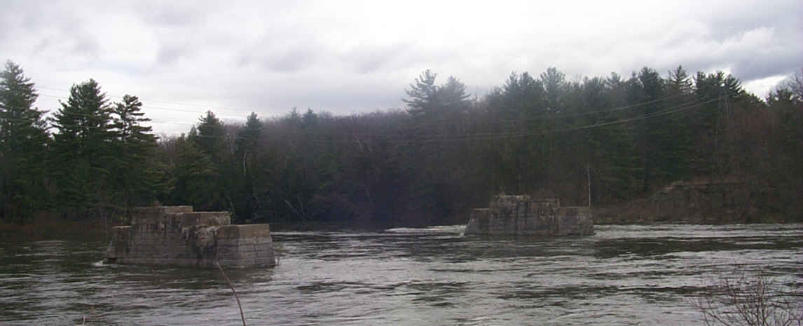
Abandoned railroad bridge abutments at Bow Junction. Digital Picture by Kenyon F. Karl on April 24, 2000
![]() USGS
Topographic map of Bow Jct
USGS
Topographic map of Bow Jct
There is no access to the rail-trail at Bow Junction because of the absence of a suitable bridge across the Merrimack River. The only access to the trail segment between the Merrimack River crossing and the Soucook River is via Garvins Falls Road from Route 3 in Concord!
Sign images are from the Manual of Traffic Signs, by Richard C. Moeur.
Updated on February 22, 2001 by Kenyon F.
Karl <[email protected]>.
Unintentional errors are likely
