


|
|
![]() USGS
Topographic map of Cherry Mtn.
USGS
Topographic map of Cherry Mtn.
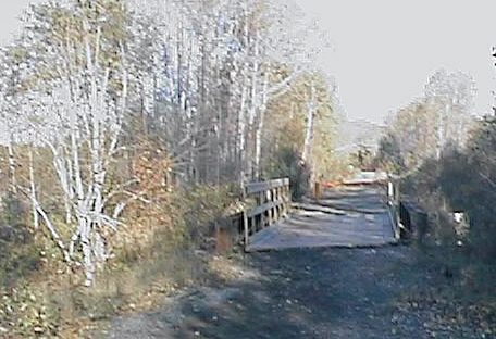
Looking east across Cherry Mill Brook Bridge. Digital photograph by Kenyon F. Karl on October 23, 1997.
The B&M Railroad applied the name 'Jefferson' to three very different points in this area at various times in its long history. To reduce confusion, the Webmaster will use the Station Name that the railroad used in 1923 to this point. Note that the B&M Railroad operated a 3.5 mile branch line into the settlement of Jefferson between 1892 and 1921 during the summer months, thus the station name Jefferson will be reserved just in case that this long forgotten railroad bed can eventually be used for trail purposes.
Note that the Mapblast Map does not accurately reflect the path of Route 115 in this area.

 The Israel River Campground (commercial) is located about 1.1 mile
northeast of Cherry Mountain Station, via Route 115A (0.66 mile) then directly
east.
The Israel River Campground (commercial) is located about 1.1 mile
northeast of Cherry Mountain Station, via Route 115A (0.66 mile) then directly
east.
Note that the Appalachian Mountain Club will establish their ultra-traditional 'August Camp' near Jefferson on the Israel River for the month of August 2001.
There are no other observable facilities in this area except for trail access at the Route 115A road crossing!
Each location map on this Web Site is a link to a map on the Mapblast Web Site which in turn contains a link to a Business Directory of the surrounding area.
Sign images are from the Manual of Traffic Signs by Richard C. Moeur.
Updated on February 28, 2001 by Kenyon F.
Karl <[email protected]>.
Unintentional errors are likely!
