


|
|
![]() USGS
Topographic map of Canobie Lake
USGS
Topographic map of Canobie Lake
![]() USGS
Aerial Photograph of Canobie Lake
USGS
Aerial Photograph of Canobie Lake
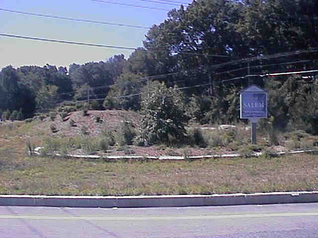
A landscaped mound of earth occupies the railroad bed just
south of the Route 111 crossing.
Digital photograph by Kenyon F. Karl on July 21, 1999.
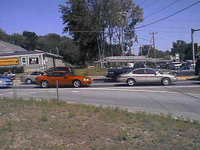
The very busy Route 111 crossing is extremely hostile to
potential rail-trail users.
Digital photograph by Kenyon F. Karl on July 21, 1999.
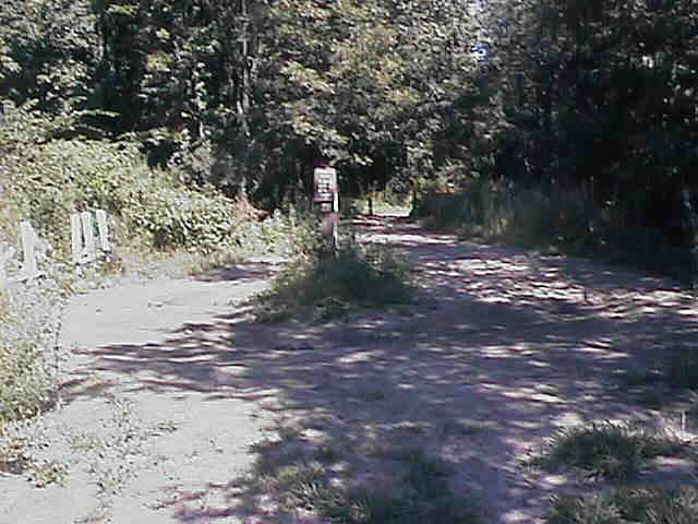
The south end of the Rockingham Recreational Trail a short
distance north of the Route 111 crossing.
Digital photograph by Kenyon F. Karl on July 21, 1999.
Motorized Trail Bikes and All Terrain Vehicles (ATV) are not allowed to pass the turn-around at the South End of the Rockingham Recreational Trail. Note that hikers, bikers, equestrians, and x-c-skiers are presumably allowed to continue down the rail-trail on the east side of the building to Route 111, or to cross over to the parking lot west of the building to reach the restaurant and bicycle shop.
Signs clearly forbid the parking and off-loading of recreational vehicles in the restaurant & bicycle shop parking lot on the north side of Route 111 that is within sight of the end of the trail. Accordingly, other trail users are likewise forbidden to park their cars in this area.
The Route 111 crossing and the parallel Route 28 are extremely hostile to trail users of all kinds. The traffic signals at the extremely busy intersection likewise make absolutely no provision for pedestrians crossing the intersection in any direction. Traffic backups likewise preclude crossing Route 111 between the Old Rockingham Road intersection and the restaurant parking lot!
A landscaped mound of earth blocks the railroad right-of-way immediately south of the Route 111 crossing. Note however that the old railroad bed does show obvious signs of trail use south of that mound of earth as far as the Old Rockingham Road Crossing.
The abandoned railroad track begins just south of the Old Rockingham Road Crossing, and a narrow foot trail continues south alongside the track for an unknown distance. However, there is no evidence of that narrow trail at the private crossing for Dodge Grain a quarter-mile south of that point.
Simple trail access to the Rockingham Trail (north of Route 111) for 'street-legal'
trail users is available at the at the following
points:
Simple trail access to the informal trail south of Route 111 for 'street-legal'
users is available at the at the following points:


 A
restaurant located at the front of the building at Route 111 is open from 8am to 4pm Monday through Saturday only. Toilets and
drinking water are presumably available inside upon request during those hours. A
bicycle shop with mechanic is located in the rear of this building. Note that
the front of this building might be the original Canobie Lake
Depot.
A
restaurant located at the front of the building at Route 111 is open from 8am to 4pm Monday through Saturday only. Toilets and
drinking water are presumably available inside upon request during those hours. A
bicycle shop with mechanic is located in the rear of this building. Note that
the front of this building might be the original Canobie Lake
Depot.
 Listed on the National Register of Historic
Places:
Listed on the National Register of Historic
Places:Note that trail users are advised to leave the trail at the Roulston Rd crossing as the shortest and safest route to the Searles School and Chapel. The specific point of interest is the 'castle' that is located a short distance north of the rather modern college classroom buildings.
Canobie Lake
Park is a privately operated amusement park offering a wide variety
of classic and modern amusement park rides. Included is a classic merry-go-round and a
classic wooden roller coaster ride. An Unofficial Home Page offers more
pictures of the important park rides at this well known amusement park. More
information about the roller coasters at this location can be found at The World of Coasters Web Site. Note
that the Webmaster is not aware of a safe route for trail users between the
rail-trail and the amusement park!
Sign images are from the Manual of Traffic Signs, by Richard C. Moeur.
